
Somerset in Pulaski County, Kentucky — The American South (East South Central)
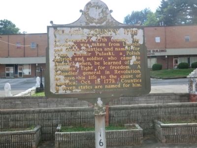
Pulaski County 1799
Photographed by Don Morfe, July 21, 2013
1. Pulaski County 1799 Marker
Erected 1977 by Kentucky Historical Society-Kentucky Department of Highways. (Marker Number 1607 - A.)
Topics and series. This memorial is listed in these topic lists: Government & Politics • War, US Revolutionary. In addition, it is included in the Kentucky Historical Society series list. A significant historical year for this entry is 1779.
Location. 37° 5.383′ N, 84° 36.333′ W. Memorial is in Somerset, Kentucky, in Pulaski County. It is on South Vine Street north of Elm Street, on the left when traveling north. Touch for map. Memorial is in this post office area: Somerset KY 42501, United States of America. Touch for directions.

Regionally, this memorial is in Kentucky’s Lake Cumberland Region. It is also in the American South, specifically in the Upper South,
this page online
Other nearby markers. At least 8 other markers are within 7 miles of this marker, measured as the crow flies: Town Spring (here, next to this marker); Morgan's First Raid (approx. ¼ mile away); Home of Governor Morrow (approx. 0.4 miles away); Russell S. Dyche Memorial Highway (approx. 0.8 miles away); Dutton's Hill Battle (approx. 1.8 miles away); Battle of Dutton's Hill Monument (approx. 2 miles away); Harriette Simpson Arnow (approx. 6.8 miles away); First Boy Scout Troop (approx. 6.9 miles away). Touch for a list and map of all markers in Somerset.
Photographed by Don Morfe, July 21, 2013
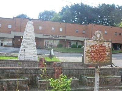
2. Pulaski County 1799 Marker
In the background is Historical Town Springs Monument
Credits. This page was last revised on June 16, 2016. It was originally submitted on August 18, 2013, by Don Morfe of Baltimore, Maryland. This page has been viewed 811 times since then and 49 times this year. Photos: 1, 2. submitted on August 18, 2013, by Don Morfe of Baltimore, Maryland. • Al Wolf was the editor who published this page.
