Near Essig in Brown County, Minnesota — The American Midwest (Upper Plains)
Taken by Surprise
Photographed by K. Linzmeier, July 30, 2013
1. Taken by Surprise Marker
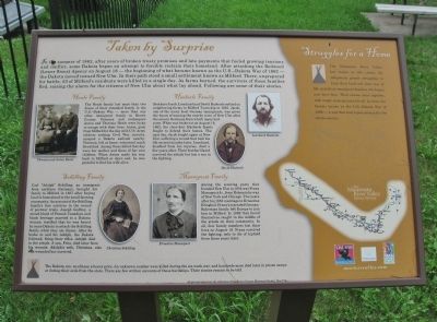
In the summer of 1862, after years of broken treaty promises and late payments that fueled growing tensions and conflict, some Dakota began an attempt to forcibly reclaim their homeland. After attacking the Redwood (Lower Sioux) Agency on August 18 — the beginning of what became known as the U.S.–Dakota War of 1862 — the Dakota moved toward New Ulm. In their path stood a small settlement known as Milford. There, unprepared for battle, 53 of Milford’s residents were killed in a single day. As farms burned, the survivors of those families fled, raising the alarm for the citizens of New Ulm about what lay ahead. Following are some of their stories.
this page online

Photographed by K. Linzmeier, July 30, 2013
2. Close-up of Marker Funding
logo of: Scenic Byway Minnesota River Valley • Minnesota Historical & Cultural Grants • Clean Water Land & Legacy Amendment
mnrivervalley.com
This project has been made possible by the Arts and Cultural Heritage Fund through the vote of Minnesotans on November 4, 2008. Administered by the Minnesota Historical Society.
The Dakota, too, would pay a heavy price. An unknown number were killed during the six-week war, and hundreds more died later in prison camps or during their exile from the state. There are few written accounts of those hardships. Their stories remain to be told.
Photographed by K. Linzmeier, July 30, 2013
3. Taken by Surprise Marker
Erected by the Minnesota Historical Society.
Topics and series. This memorial is listed in these topic lists: Settlements & Settlers • Wars, US Indian. In addition, it is included in the Minnesota Historical Society series list. A significant historical year for this entry is 1862.
Location. 44° 21.391′ N, 94° 35.603′ W. Memorial is near Essig, Minnesota, in Brown County. It is at the intersection of County Road 11 and County Road 29, on the left when traveling north on County Road 11. Touch for map. Memorial is in this post office area: Essig MN 56030, United States of America. Touch for directions.

Regionally, this memorial is in Southwest Minnesota and specifically in the Minnesota River Valley. It is also in the American Midwest and in the Corn Belt. Globally, it is in North America, the Western
Photographed by K. Linzmeier, July 30, 2013
4. Milford Monument
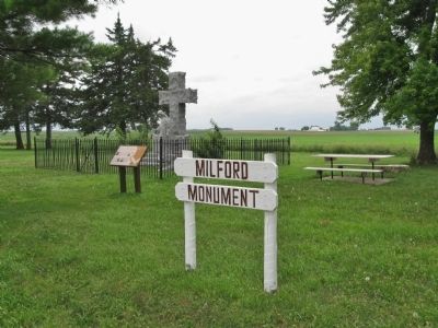
Other nearby markers. At least 8 other markers are within 6 miles of this marker, measured as the crow flies: Junior Pioneers Tablet (here, next to this marker); Milford State Monument (here, next to this marker); Ravine Ambush (approx. 0.6 miles away); The Milford Reservation Line (approx. one mile away); Harkin Store (approx. 2.1 miles away); Essig, Minnesota (approx. 2.3 miles away); Turnverein Founding Site (approx. 4½ miles away); Pioneer Monument (approx. 5.4 miles away). Touch for a list and map of all markers in Essig.
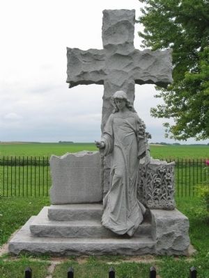
More about this memorial. This marker is at the Milford Monument, erected by the State of Minnesota in 1929 in the memory of the men, women and children of Milford who were massacred August 18, 1862.
photo captions, clockwise:
• Theresia and Anton Henle
• Leonhard Haeberle
• David Haeberle
• Ernestine Massopust
• Christina Schilling
All photographs from the collection of the Brown County Historical Society, New Ulm.
Also see . . . Minnesota River Valley Scenic Byway. (Submitted on August 20, 2013.)
Credits. This page was last revised on June 16, 2016. It was originally submitted on August 20, 2013, by Keith L of Wisconsin Rapids, Wisconsin. This page has been viewed 2,456 times since then and 85 times this year. Photos: 1, 2, 3, 4. submitted on August 20, 2013, by Keith L of Wisconsin Rapids, Wisconsin.
