Near Sinclair in Carbon County, Wyoming — The American West (Mountains)
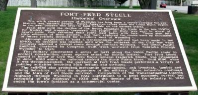
Fort Fred Steele
Historical Overview
From 1810 until the decline of the Rocky Mountain fur trade in the late 1830's, fur traders and trappers traversed this region on their way west in quest of beaver pelts, then retraced their route east laden with furs. These men left little evidence of their passing, but they explored the routes used by thousands of settlers destined for locations west of Wyoming.
Although suggestions to build a transcontinental railroad had been made in the 1840's, no decision was reached until after the outbreak of the Civil War when Congress selected a central route through southern Wyoming. The Union Pacific Railroad, chartered by Congress, built track westward from Nebraska through Wyoming to Utah.
The military constructed a series of forts along the Union Pacific route to protect construction crews against attack by hostile Indians. Fort Fred Steele, named in honor of Civil War hero Major General Frederick Steele, was established in June, 1868 where the railroad crossed the North Platte River. Until 1886, when it was decommissioned, the garrison at Fort Fred Steele performed a variety of policing activities involving both Indians and civilians.
The railroad also promoted mercantile development, and livestock, lumber and mining industries. After the departure of the military, these industries continued and the town of Fort Steele survived. Completion of the transcontinental Lincoln Highway through Wyoming in 1922 contributed to a brief economic revival but rerouting of the highway in 1939 and the demise of the tie industry in 1940 ended the town's function as a commercial center.
Topics. This historical marker is listed in these topic lists: Forts and Castles • Native Americans • Railroads & Streetcars • Settlements & Settlers. A significant historical month for this entry is June 1868.
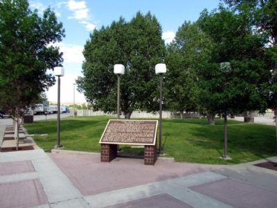
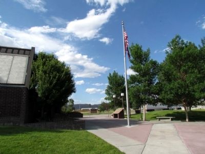
Location. 41° 45.196′ N, 106° 57.055′ W. Marker is near Sinclair, Wyoming, in Carbon County. Marker can be reached from Old Highway, 0.1 miles east of County Road 347, on the left when traveling east. Marker is located at the I-80 rest area at Exit 228 which is accessible to both eastbound and westbound traffic. Touch for map. Marker is in this post office area: Sinclair WY 82334, United States of America. Touch for directions.
Other nearby markers. At least 8 other markers are within 2 miles of this marker, measured as the crow flies. Wyoming - A Fortress for Wildlife (within shouting distance of this marker); Ranching Central (within shouting distance of this marker); Cemetery (approx. 1˝ miles away); Powder Magazine (approx. 1˝ miles away); Fenimore Chatterton (approx. 1˝ miles away); A Tourist's Railroad (approx. 1˝ miles away); Early Construction (approx. 1˝ miles away); Fort Fred Steele State Historic Site (approx. 1˝ miles away). Touch for a list and map of all markers in Sinclair.
Additional commentary.
1. Fort Fred Steele Historic Site
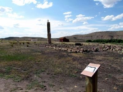
Fort Fred Steele is located approximately two miles north of the rest area at the end of County Road 347.
— Submitted August 22, 2013, by Duane Hall of Abilene, Texas.
Credits. This page was last revised on September 18, 2020. It was originally submitted on August 22, 2013, by Duane Hall of Abilene, Texas. This page has been viewed 595 times since then and 19 times this year. Photos: 1, 2, 3, 4. submitted on August 22, 2013, by Duane Hall of Abilene, Texas.


