Laramie in Albany County, Wyoming — The American West (Mountains)
Site of Fort Sanders
Photographed by Duane Hall, July 6, 2013
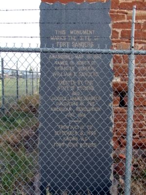
1. Fort Sanders Marker
Marks the Site of
Fort Sanders
Established September 5, 1866
Abandoned May 18, 1882
Named in Honor of
Brigadier General
William P. Sanders
Erected by the
State of Wyoming
and
Jacques Laramie Chapter
Daughters of the
American Revolution
June 1914
From July 10, to
September 5, 1866
Known as
Fort John Buford
Erected 1914 by State of Wyoming and Jacques Laramie Chapter of Daughters of the American Revolution.
Topics and series. This historical marker is listed in this topic list: Forts and Castles. In addition, it is included in the Daughters of the American Revolution (DAR) series list. A significant historical date for this entry is May 18, 1867.
Location. 41° 16.278′ N, 105° 35.89′ W. Marker is in Laramie, Wyoming, in Albany County. It is on S. Kiowa Street 0.1 miles east of Fort Sanders Road, on the right when traveling east. Touch for map. Marker is in this post office area: Laramie WY 82070, United States of America. Touch for directions.

Regionally, this marker is in Wyoming’s Laramie Basin. It is also in the American Mountain West. Globally, it is in North America, the Rocky
this page online
Other nearby markers. At least 8 other markers are within 3 miles of this marker, measured as the crow flies: Ft. Sanders (approx. ¼ mile away); Laramie (approx. 2 miles away); George Adams Wyman (approx. 2.6 miles away); 407 S. 2nd Street (approx. 2.7 miles away); First Woman Jury (approx. 2.7 miles away); Commemorating Women of Laramie (approx. 2.7 miles away); Johnson Lummis Hunkins Plaza (approx. 2.7 miles away); Bet You Didn't Know... (approx. 2.7 miles away). Touch for a list and map of all markers in Laramie.
Another marker is no longer nearby. Laramie (was approx. 2.6 miles away but has been confirmed missing).
Photographed by Duane Hall, July 6, 2013
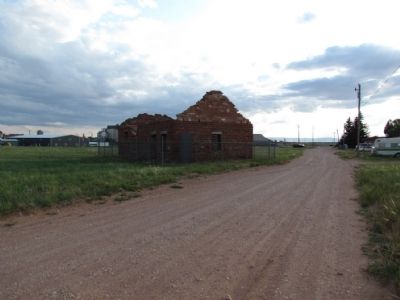
2. View to east along S. Kiowa Street
Photographed by Duane Hall, July 6, 2013
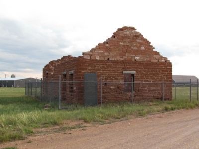
3. Remains of Fort Sanders Guardhouse
Photographed by Duane Hall, July 6, 2013
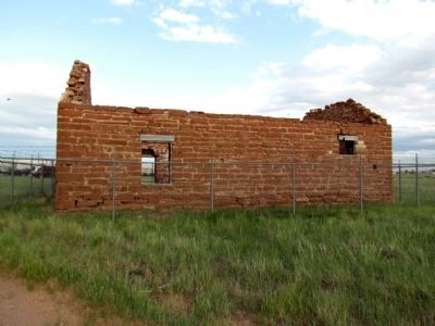
4. Remains of Fort Sanders Guardhouse
Credits. This page was last revised on September 18, 2020. It was originally submitted on August 22, 2013, by Duane Hall of Abilene, Texas. This page has been viewed 1,248 times since then and 195 times this year. Photos: 1, 2, 3, 4. submitted on August 22, 2013, by Duane Hall of Abilene, Texas.
