Near Eclectic in Elmore County, Alabama — The American South (East South Central)
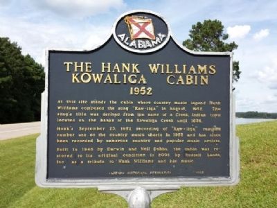
The Hank Williams Kowaliga Cabin
1952
Photographed by Mark Hilton, August 23, 2013
1. The Hank Williams Kowaliga Cabin Marker
Hank’s September 23, 1952 recording of “Kaw-liga” reached number one on the country music charts in 1953 and has since been recorded by numerous country and popular music artists.
Built in 1946 by Darwin and Nell Dobbs, the cabin was restored to its original condition in 2001 by Russell Lands, Inc. as a tribute to Hank Williams and his music.
Erected 2002 by Alabama Historical Association.
Topics and series. This historical marker is listed in these topic lists: Arts, Letters, Music • Entertainment. In addition, it is included in the Alabama Historical Association series list. A significant historical date for this entry is September 23, 2010.
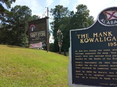
Location. 32° 44.219′ N, 85° 58.095′ W. Marker is near Eclectic, Alabama, in Elmore County. It is on Alabama Route 63 0.2 miles north of Kowaliga Marina Road, on the left when traveling south. Located in front of Children's Harbor near the southern
this page online

Regionally, this marker is in the Tri-Counties River Region. It is also in the American South and specifically in the Deep South. Globally, it is in North America, a Gulf of Mexico state, the Western Hemisphere, the Western World, and the Anglosphere. Historically, it finds itself in what was once New Spain, the territory of the Mississippian Culture, one of the Confederate States of America, and the Antebellum South.
Other nearby markers. At least 8 other markers are within 14 miles of this marker, measured as the crow flies: The Rock Store / The Rock Store's Cosby Family (approx. 10.8 miles away); William Carl Roeck (approx. 11.1 miles away); Peace & Goodwill Cemetery (approx. 11.7 miles away); Fort Okfuskee (approx. 12.1 miles away); Site of Thaddeus Post Office (approx. 13.2 miles away); Horseshoe Bend Battle Ground (approx. 13.3 miles away); First Baptist Church (approx. 13½ miles away); Dadeville Coca-Cola Company
Photographed by Mark Hilton, August 23, 2013
2. Marker In front of Children's Harbor
Another marker is no longer nearby. Menawa, War Chief (was approx. 8.3 miles away but has been confirmed missing).
Credits. This page was last revised on September 12, 2023. It was originally submitted on August 23, 2013, by Mark Hilton of Montgomery, Alabama. This page has been viewed 2,892 times since then and 201 times this year. Photos: 1, 2. submitted on August 23, 2013, by Mark Hilton of Montgomery, Alabama. • Bernard Fisher was the editor who published this page.
