Near Buford in Albany County, Wyoming — The American West (Mountains)
Sherman Mountains
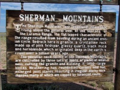
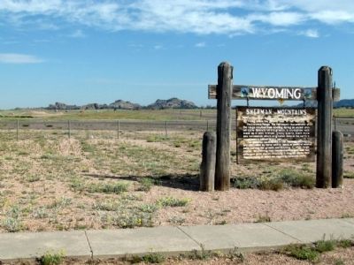
The peculiar rock forms of the Sherman Mountains are controlled by three sets of joints, or planes of weakness, cutting the granite and dividing it into large blocks. Weathering has rounded off corners and has enlarged joint planes, resulting in irregular block rock masses, many of which are capped by balance rocks.
Topics. This historical marker is listed in this topic list: Natural Features.
Location. 41° 8.026′ N, 105° 20.806′ W. Marker is near Buford, Wyoming, in Albany County. Marker can be reached from Interstate 80 at milepost 332, on the left when traveling east. The marker is located in a median pullout on I-80. It is 3.3 miles east of Exit 329 and 2.3 miles west of Exit 335. Touch for map. Marker is in this post office area: Buford WY 82052, United States of America. Touch for directions.
Other nearby markers. At least 8 other markers are within 9 miles of this marker, measured as the crow flies. Tree Rock (a few steps from this marker); Tree in the Rock (a few steps from this marker); Lonetree on the Laramie Range (a few steps from this marker); Ames Monument (approx. 2.7 miles away); The Transcontinental Railroad (approx. 2.7 miles away); Pyramid on the Plains (approx. 2.7 miles away); Old Sherman Cemetery (approx. 2.8 miles away); The Purple Heart Trail (approx. 8˝ miles away). Touch for a list and map of all markers in Buford.
Credits. This page was last revised on June 16, 2016. It was originally submitted on August 24, 2013, by Duane Hall of Abilene, Texas. This page has been viewed 1,123 times since then and 69 times this year. Photos: 1, 2. submitted on August 24, 2013, by Duane Hall of Abilene, Texas.

