Mayfield in Fulton County, New York — The American Northeast (Mid-Atlantic)
Dutch Reformed Church of Mayfield
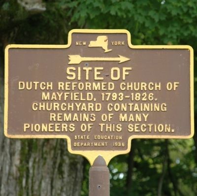
Photographed by Howard C. Ohlhous, August 27, 2013
1. Dutch Reformed Church of Mayfield Marker
Site Of
Dutch Reformed Church of
Mayfield, 1793-1826.
Churchyard containing
remains of many
pioneers of this section.
Erected 1936 by New York State Department of Education.
Topics. This historical marker is listed in these topic lists: Cemeteries & Burial Sites • Religion & Religious Structures • Settlements & Settlers.
Location. 43° 6.145′ N, 74° 15.785′ W. Marker is in Mayfield, New York, in Fulton County. It is on School Street, on the right when traveling east. Marker is across the street from the Mayfield Jr. - Sr. High School, and outside the fence of the Union Rural Cemetery. Touch for map. Marker is in this post office area: Mayfield NY 12117, United States of America. Touch for directions.

Regionally, this marker is in Upstate New York and in the Mohawk Valley. It is also in the American Northeast and in the Mid-Atlantic. Globally, it is in North America, the Great North Woods, the Western Hemisphere, the Western World, and the Anglosphere. Historically, it finds itself in what was once the Haudenosaunee
this page online
Other nearby markers. At least 8 other markers are within 2 miles of this marker, measured as the crow flies: Romeyn's Mill (approx. half a mile away); Mayfield Lake (approx. half a mile away); Burying Ground (approx. 0.7 miles away); Rice Homestead (approx. ¾ mile away); Anthonyville (approx. 1.1 miles away); Indian Raid (approx. 1.1 miles away); Captain Solomon Woodworth (approx. 1.1 miles away); Riceville Cemetery (approx. 1.2 miles away). Touch for a list and map of all markers in Mayfield.
Regarding Dutch Reformed Church of Mayfield. This early church was established in 1793 and stood on this site until 1826. The churchyard was used for burials of Mayfield’s early settlers. The oldest burials are on the side near the marker. This cemetery now connects with the modern one. Note: Please see the large Getman Memorial Monument. Captain Getman commanded a Civil War Cavalry Unit and this memorial honors both the captain and his men. It is yet another marker suggested by then Town Historian E.J. Rullifson in 1936.
Also see . . . The Great Sacandaga Lake.
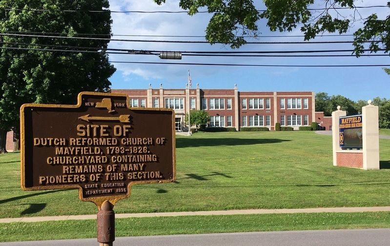
Photographed by Howard C. Ohlhous, July 21, 2022
2. Dutch Reformed Church of Mayfield Marker
The marker is directly across School Street from the Mayfield Junior - Senior High School.
Additional keywords. Sacandaga
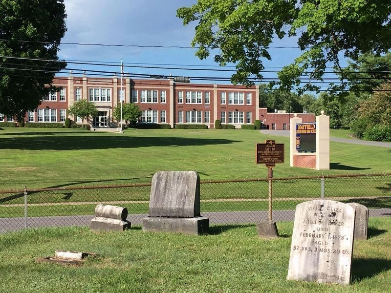
Photographed by Howard C. Ohlhous, July 21, 2022
3. Dutch Reformed Church of Mayfield Marker
The marker is seen from within the Union Rural Cemetery.
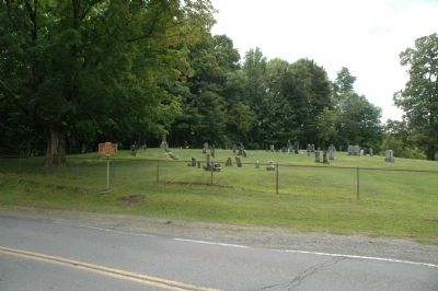
Photographed by Howard C. Ohlhous, August 27, 2013
4. Dutch Reformed Church of Mayfield Marker
That area beyond the marker is the Union Rural Cemetery in Mayfield.
Photographed by Howard C. Ohlhous, August 27, 2013
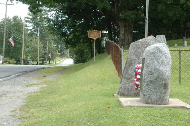
5. Dutch Reformed Church of Mayfield Marker
The view here is to the east along School Street, past the Mayfield Veterans Memorials.
Credits. This page was last revised on July 24, 2022. It was originally submitted on August 28, 2013, by Howard C. Ohlhous of Duanesburg, New York. This page has been viewed 902 times since then and 48 times this year. Photos: 1. submitted on August 28, 2013, by Howard C. Ohlhous of Duanesburg, New York. 2, 3. submitted on July 22, 2022, by Howard C. Ohlhous of Duanesburg, New York. 4, 5. submitted on August 28, 2013, by Howard C. Ohlhous of Duanesburg, New York. • Bill Pfingsten was the editor who published this page.
