Liberty in Clay County, Missouri — The American Midwest (Upper Plains)
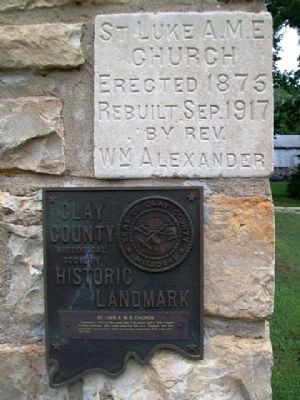
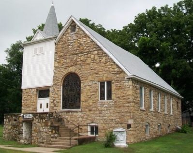
St. Luke A.M.E. Church
Clay County Historical Society
— Historic Landmark —
Erected by Clay County Historical Society.
Topics and series. This historical marker is listed in these topic lists: African Americans • Churches & Religion • Landmarks. In addition, it is included in the African Methodist Episcopal (AME) Church, and the Missouri, Clay County Historic Landmarks series lists. A significant historical year for this entry is 1875.
Location. 39° 15.066′ N, 94° 25.213′ W. Marker is in Liberty, Missouri, in Clay County. Marker is on Main Street, on the right when traveling north. Touch for map. Marker is at or near this postal address: 443 North Main Street, Liberty MO 64068, United States of America. Touch for directions.
Other nearby markers. At least 8 other markers are within walking distance of this marker. Lightburne Hall (approx. 0.2 miles away); Liberty Mormon Jail (approx. 0.2 miles away); Liberty Presbyterian Church (approx. 0.2 miles away); Goldman-Duckworth House (approx. ¼ mile away); Doniphan – Hubbell House (approx. ¼ mile away); Alexander W. Doniphan (approx. ¼ mile away); Liberty Lodge No. 49 I.O.O.F. (approx. ¼ mile away); Liberty Tribune (approx. 0.3 miles away). Touch for a list and map of all markers in Liberty.
Credits. This page was last revised on December 16, 2020. It was originally submitted on August 30, 2013, by William Fischer, Jr. of Scranton, Pennsylvania. This page has been viewed 552 times since then and 17 times this year. Photos: 1, 2, 3. submitted on August 30, 2013, by William Fischer, Jr. of Scranton, Pennsylvania.


