Harrodsburg in Mercer County, Kentucky — The American South (East South Central)
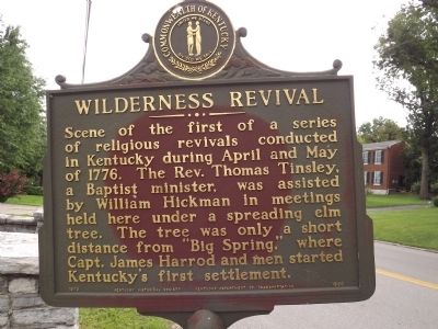
Wilderness Revival
Erected 1975 by Kentucky Historical Society & Kentucky Department of Highways. (Marker Number 1530.)
Topics and series. This historical marker is listed in these topic lists: Churches & Religion • Settlements & Settlers. In addition, it is included in the Kentucky Historical Society series list. A significant historical month for this entry is May 1776.
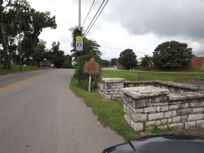
Location. 37° 45.78′ N, 84° 50.14′ W. Marker is in Harrodsburg, Kentucky, in Mercer County. Marker is on East Lexington Street (U.S. 68) east of Woodland Avenue, on the right when traveling west. Touch for map. Marker is at or near this postal address: 427 East Lexington Street, Harrodsburg KY 40330, United States of America. Touch for directions.
Other nearby markers. At least 8 other markers are within walking distance of this marker. The Baptist Tabernacle of The Wilderness (here, next to this marker); Muscoe Garnett House (within shouting distance of this marker); Lucy Newton Cogar House (approx. 0.2 miles away); The Big Spring (approx. 0.2 miles away); "The Big Spring" (approx. 0.2 miles away); Isaac Hipple House (approx. 0.2 miles away); Thompson / Wickliffe House (approx. 0.2 miles away); Woodsland (approx. 0.3 miles away). Touch for a list and map of all markers in Harrodsburg.
Credits. This page was last revised on June 16, 2016. It was originally submitted on August 31, 2013, by Ken Smith of Milan, Tennessee. This page has been viewed 610 times since then and 38 times this year. Photos: 1, 2. submitted on August 31, 2013, by Ken Smith of Milan, Tennessee. • Al Wolf was the editor who published this page.

