
Durazno in El Paso in El Paso County, Texas — The American South (West South Central)
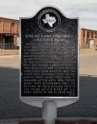
Site of Camp Concordia and Fort Bliss
Photographed by PaulwC3, July 20, 2013
1. Site of Camp Concordia and Fort Bliss Marker
Erected 1982 by Texas Historical Commission. (Marker Number 4740.)
Topics. This historical marker is listed in these topic lists: Forts and Castles • Settlements & Settlers. A significant historical year for this entry is 1868.
Location. 31° 46.53′ N, 106° 26.687′ W. Marker is in El Paso, Texas, in El Paso County. It is in Durazno. It is at the intersection of North Martinez Street and Rosa Avenue, on the left when traveling north on North Martinez Street. The marker is located on the surface streets directly below the elevated roads of Patriot Freeway (Interstate 100/US-54). The
this page online

Regionally, this marker is in Texas’ Trans-Pecos & Big Bend Region. It is also in the American Southwest. Globally, it is in North America, a Gulf of Mexico state, the Western Hemisphere, the Western World, and the Anglosphere. Historically, it finds itself in what was once New Spain, the Republic of Texas, and one of the Confederate States of America.
Other nearby markers. At least 8 other markers are within walking distance of this marker: Henry C. Trost (about 800 feet away, measured in a direct line); Victoriano Huerta (approx. 0.2 miles away); Urbici Soler (approx. 0.2 miles away); James H. White (approx. 0.4 miles away); The Mormon Plot in Concordia Cemetery (approx. 0.4 miles away); John Wesley Hardin (approx. 0.4 miles away); Concordia Cemetery (approx. half a mile away); Fort Bliss Buffalo Soldiers Memorial (approx. half a mile away). Touch for a list and map of
Photographed by PaulwC3, July 20, 2013
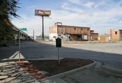
2. Wide view of the Site of Camp Concordia and Fort Bliss Marker
Related marker. Click here for another marker that is related to this marker. To better understand the relationship, study each marker in the order shown.
Also see . . .
1. Fort Bliss | The Handbook of Texas Online| Texas State Historical Association (TSHA). (Submitted on September 1, 2013, by PaulwC3 of Northern, Virginia.)
2. This marker was damaged during an I-10 road project and was replaced. The marker was replaced on March 30th, 2025. (Submitted on March 31, 2025, by Mark Hilton of Montgomery, Alabama.)
Credits. This page was last revised on March 31, 2025. It was originally submitted on September 1, 2013, by PaulwC3 of Northern, Virginia. This page has been viewed 1,584 times since then and 69 times this year. Photos: 1, 2. submitted on September 1, 2013, by PaulwC3 of Northern, Virginia.
