Verbena in Chilton County, Alabama — The American South (East South Central)
Verbena, Alabama
Photographed by Mark Hilton, September 1, 2013
1. Verbena Alabama Marker
Inscription.
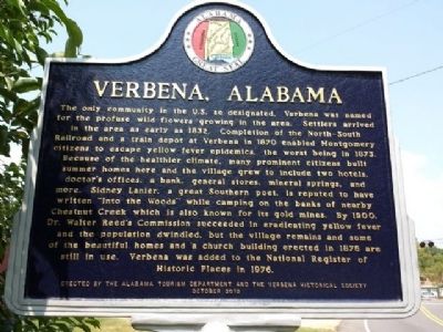
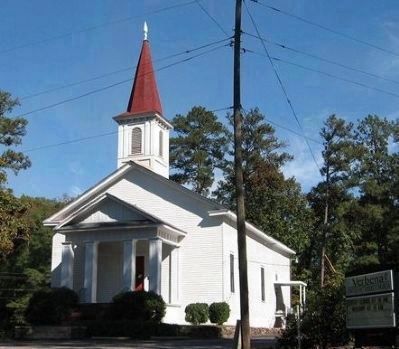
Verbena, Alabama. . The only community in the U.S. so designated, Verbena was named for the profuse wild flowers growing in the area. Settlers arrived in the area as early as 1832. Completion of the North-South Railroad and a train depot at Verbena in 1870 enabled Montgomery citizens to escape yellow fever epidemics, the worst being in 1873. Because of the healthier climate, many prominent citizens built summer homes here and the village grew to include two hotels, doctor's offices, a bank, general stores, mineral springs, and more. Sidney Lanier, a great Southern poet, is reputed to have written “Into the Woods” while camping on the banks of nearby Chestnut Creek which is also known for its gold mines. By 1900, Dr. Walter Reed's Commission succeeded in eradicating yellow fever and the population dwindled, but the village remains and some of the beautiful homes and a church building erected in 1876 are still in use. Verbena was added to the National Register of Historic Places in 1976.
The only community in the U.S. so designated, Verbena was named for the profuse wild flowers growing in the area. Settlers arrived in the area as early as 1832. Completion of the North-South Railroad and a train depot at Verbena in 1870 enabled Montgomery citizens to escape yellow fever epidemics, the worst being in 1873. Because of the healthier climate, many prominent citizens built summer homes here and the village grew to include two hotels, doctor's offices, a bank, general stores, mineral springs, and more. Sidney Lanier, a great Southern poet, is reputed to have written “Into the Woods” while camping on the banks of nearby Chestnut Creek which is also known for its gold mines. By 1900, Dr. Walter Reed's Commission succeeded in eradicating yellow fever and the population dwindled, but the village remains and some of the beautiful homes and a church building erected in 1876 are still in use. Verbena was added to the National Register of Historic Places in 1976.
Erected 2010 by Alabama Tourism Department and the Verbena Historical Society.
Topics and series. This historical marker is listed in
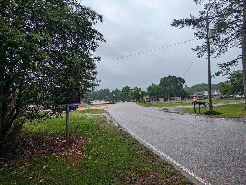
Location. 32° 45.163′ N, 86° 30.732′ W. Marker is in Verbena, Alabama, in Chilton County. It is on County Road 59 0.1 miles south of U.S. 31, on the right when traveling south. Touch for map. Marker is at or near this postal address: 8315 County Road 59, Verbena AL 36091, United States of America. Touch for directions.
Regionally, this marker is in the Birmingham Metropolitan Area. It is also in the American South and specifically in the Deep South. Globally, it is in North America, a Gulf of Mexico state, the Western Hemisphere, the Western World, and the Anglosphere. Historically, it finds itself in what was once the territory of the Mississippian Culture, one of the Confederate States of America, and the Antebellum South.
Other nearby markers. At least 8 other markers are within 4 miles of this marker, measured as the crow flies: The Hospital (approx. 3 miles away); Army Barracks for Enlisted Men
Credits. This page was last revised on May 23, 2023. It was originally submitted on September 1, 2013, by Mark Hilton of Montgomery, Alabama. This page has been viewed 2,926 times since then and 160 times this year. Photos:1. submitted on September 1, 2013, by Mark Hilton of Montgomery, Alabama. 2. submitted on May 23, 2023, by Mike Wintermantel of Pittsburgh, Pennsylvania. 3. submitted on September 1, 2013, by Mark Hilton of Montgomery, Alabama. • Bernard Fisher was the editor who published this page.