Liberty in Clay County, Missouri — The American Midwest (Upper Plains)
Founding Fathers
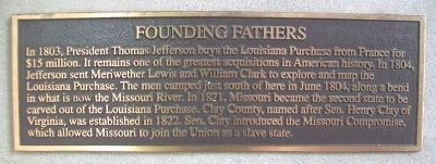
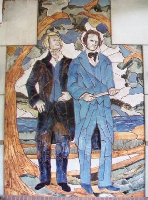
In 1803, President Thomas Jefferson buys the Louisiana Purchase from France for $15 million. It remains one of the greatest acquisitions in American history. In 1804, Jefferson sent Meriwether Lewis and William Clark to explore and map the Louisiana Purchase. The men camped just south of here in June 1804, along a bend in what is now the Missouri River. In 1821, Missouri became the second state to be carved out of the Louisiana Purchase. Clay County, named for Sen. Henry Clay of Virginia, was established in 1822. Sen. Clay introduced the Missouri Compromise, which allowed Missouri to join the Union as a slave state.
Topics and series. This historical marker is listed in these topic lists: Exploration • Government & Politics • Settlements & Settlers • Waterways & Vessels. In addition, it is included in the Former U.S. Presidents: #03 Thomas Jefferson, and the Lewis & Clark Expedition series lists. A significant historical month for this entry is June 1804.
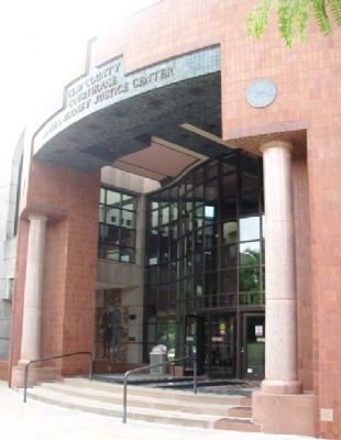
Location. 39° 14.721′ N, 94° 25.142′ W. Marker is in Liberty, Missouri, in Clay County. Marker is near the entrance to the James S. Rooney Justice Center. Touch for map. Marker is at or near this postal address: 11 South Water Street, Liberty MO 64068, United States of America. Touch for directions.
Other nearby markers. At least 8 other markers are within walking distance of this marker. Clay County American Revolution Veterans (a few steps from this marker); Jurisprudence (a few steps from this marker); John Dougherty (a few steps from this marker); Scales and Rails (within shouting distance of this marker); First Court House Site (within shouting distance of this marker); War Memorial (within shouting distance of this marker); Intelligencia (within shouting distance of this marker); Sacred Waters (within shouting distance of this marker). Touch for a list and map of all markers in Liberty.
Also see . . .
1. Thomas Jefferson: A Brief Biography. (Submitted on September 3, 2013, by William Fischer, Jr. of Scranton, Pennsylvania.)
2. Henry Clay Biography. (Submitted on September 3, 2013, by William Fischer, Jr. of Scranton, Pennsylvania.)
3. Lewis and Clark Across Missouri. (Submitted on September 3, 2013, by William Fischer, Jr. of Scranton, Pennsylvania.)
4. Clay County (MO) Archives and Historical Library. (Submitted on September 3, 2013, by William Fischer, Jr. of Scranton, Pennsylvania.)
Credits. This page was last revised on April 26, 2022. It was originally submitted on September 3, 2013, by William Fischer, Jr. of Scranton, Pennsylvania. This page has been viewed 565 times since then and 25 times this year. Photos: 1, 2, 3. submitted on September 3, 2013, by William Fischer, Jr. of Scranton, Pennsylvania.


