Hegins in Schuylkill County, Pennsylvania — The American Northeast (Mid-Atlantic)
Tulpehocken Path
Photographed by PaulwC3, August 3, 2013
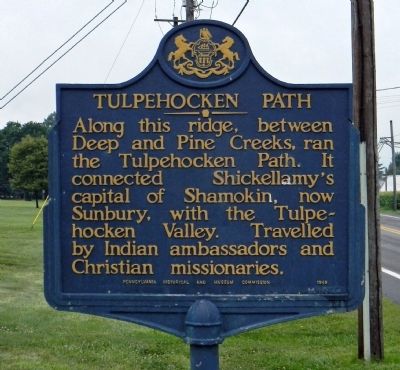
1. Tulpehocken Path Marker
Along this ridge, between Deep and Pine Creeks, ran the Tulpehocken Path. It connected Shickellamy's capital of Shamokin, now Sunbury, with the Tulpehocken Valley. Travelled by Indian ambassadors and Christian missionaries.
Erected 1950 by Pennsylvania Historical and Museum Commission.
Topics and series. This historical marker is listed in this topic list: Indigenous Peoples and Communities. In addition, it is included in the Pennsylvania Historical and Museum Commission (PHMC) series list.
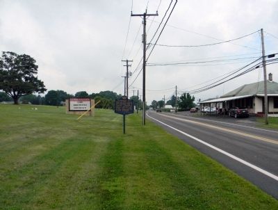
Location. 40° 38.894′ N, 76° 31.055′ W. Marker is in Hegins, Pennsylvania, in Schuylkill County. It is on East Main Street (Pennsylvania Route 25) 0.1 miles east of Division Street, on the right when traveling east. The marker is in front of the Tri-Valley Jr-Sr High School. Touch for map. Marker is at or near this postal address: 155 East Main Street, Hegins PA 17938, United States of America. Touch for directions.

Regionally, this marker is in Anthracite Coal Region. It is also in the American Northeast, in the Mid-Atlantic, in Appalachia, and specifically in Northern Appalachia.
this page online
Other nearby markers. At least 8 other markers are within 5 miles of this marker, measured as the crow flies: War Memorial (approx. 0.7 miles away); William B. and Margaretha Kessler Otto (approx. 0.7 miles away); War and Veterans Memorial (approx. 3.9 miles away); Les Brown (approx. 3.9 miles away); a different marker also named War Memorial (approx. 4.4 miles away); Elias Shomper (approx. 4½ miles away); Johannes Hand (approx. 4½ miles away); Tower City Borough, Porter & Rush Townships Veterans Memorial (approx. 4½ miles away). Touch for a list and map of all markers in Hegins.
Related markers. Click here for a list of markers that are related to this marker. To better understand the relationship, study each marker shown.
Also see . . . The Tulpehocken Path. Lykens Valley website entry (Submitted on September 7, 2022, by Larry Gertner of New York, New York.)
Photographed by PaulwC3, August 3, 2013
2. Wide view of the Tulpehocken Path Marker
Credits. This page was last revised on September 7, 2022. It was originally submitted on September 5, 2013, by PaulwC3 of Northern, Virginia. This page has been viewed 857 times since then and 26 times this year. Photos: 1, 2. submitted on September 5, 2013, by PaulwC3 of Northern, Virginia.
