Greenbelt in Prince George's County, Maryland — The American Northeast (Mid-Atlantic)
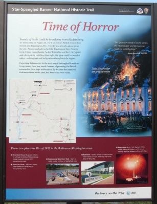
Time of Horror
Star-Spangled Banner National Historic Trail
Photographed by F. Robby, September 10, 2013
1. Time of Horror Marker
Expecting Baltimore to be the next target, bedraggled American troops made their way north. Instead of pursuing, the British returned to their ships at Benedict. By the time they attacked Baltimore three weeks later, the Americans were ready.
Places to explore the War of 1812 in the Baltimore-Washington area:
Riversdale House Museum - Home of witness to Battle of Bladensburg; house museum; annual 1812 reenactment event.
Oxon Cove Park - 1812-era home; part of National Park Service living-history farm.
Bladensburg Waterfront Park - Start at visitor center for tour of battlefield sites.
Baltimore - Visitor center in Inner Harbor; information on Fort McHenry and other War of 1812
this page online
Washington, D.C. - U.S. Capitol, White House, National Museum of American History, National Museum of the U.S. Navy.
[Side 2]
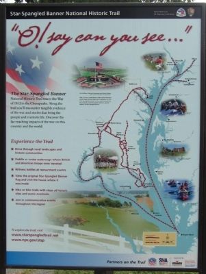
O! say can you see..."
The Star-Spangled Banner National Historic Trail traces the War of 1812 in the Chesapeake. Along the trail you'll encounter tangible evidence of the war and stories that bring the people and events to life. Discover the far-reaching impacts of the war on this county and the world.
[Side 3]
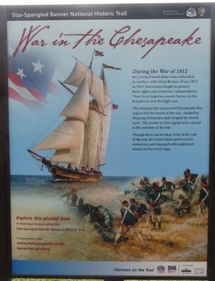
War in the Chesapeake
During the War of 1812 the young United States was embroiled in conflict with Great Britain. From 1812 to 1815 Americans fought to protect their rights and economic independence. They faced superior enemy forces on the homefront and the high seas.
The stategically important Chesapeake Bay region felt the brunt of the war, choked by shipping blockades and ravaged by enemy raids. The events in this region were crucial to the outcome of the war.
Though there was no clear victor at the end of the war, the United States protected its democracy and emerged with heightened stature on the world stage.
Erected by National Parks Service.
Topics and series.
Photographed by F. Robby, September 10, 2013
2. Time of Horror Marker
Location. 38° 59.63′ N, 76° 53.682′ W. Marker is in Greenbelt, Maryland, in Prince George's County. It can be reached from Greenbelt Road (Maryland Route 193) 0.7 miles west of Southway, on the left when traveling west. Marker is in Greenbelt Park, inside the center loop. Touch for map. Marker is in this post office area: Greenbelt MD 20770, United States of America. Touch for directions.

Regionally, this marker is in the Washington Metropolitan Area. It is also in the American South, specifically in the Upper South, in the Mid-Atlantic, and on the Eastern Seaboard. Globally, it is in the North Atlantic Region, North America, the Western Hemisphere, the Western World, and the Anglosphere. Historically, it finds itself in what was once one of the original Thirteen Colonies and also the Antebellum South.
Other nearby markers. At least 8 other markers are within walking distance of this marker: Greenbelt: A Bold Experiment
Photographed by F. Robby, September 10, 2013
3. Time of Horror Marker
Photographed by F. Robby, September 10, 2013
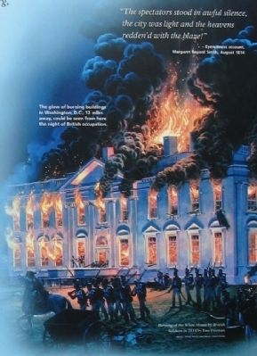
4. Burning of the White House
"The spectators stood in awful silence, the city was light and the heavens redden'd with the blaze!" - Eyewitness account, Margaret Bayard Smith, August 1814. The glow of the burning buildings in Washington, D.C., 12 miles away, could be seen from here the night of British occupation.
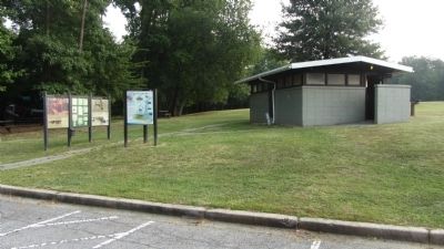
Photographed by F. Robby, September 10, 2013
5. Time of Horror Marker
Credits. This page was last revised on June 16, 2016. It was originally submitted on September 10, 2013, by F. Robby of Baltimore, Maryland. This page has been viewed 1,052 times since then and 72 times this year. Photos: 1, 2, 3, 4, 5. submitted on September 10, 2013, by F. Robby of Baltimore, Maryland.
