
Fort Howard in Edgemere in Baltimore County, Maryland — The American Northeast (Mid-Atlantic)
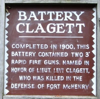
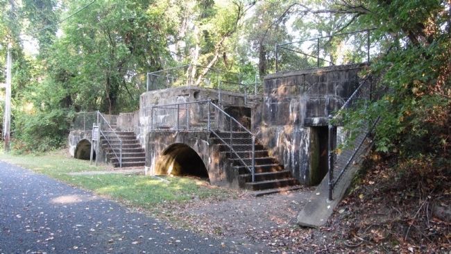
Battery Clagett
Photographed by F. Robby, September 10, 2013
1. Battery Clagett Marker
Erected 1981 by Patapsco Neck Bicentennial Committee.
Topics. This historical marker is listed in these topic lists: Forts and Castles • War, Spanish-American. A significant historical year for this entry is 1900.
Location. This marker has been replaced by another marker nearby. It was located near 39° 11.917′ N, 76° 26.406′ W. Marker was in Edgemere, Maryland, in Baltimore County. It was in Fort Howard. It could be reached from Fort Howard Park Road 0.6 miles south of North Point Road (Old Maryland Route 20) when traveling south. Marker is about 1000 feet east of the parking lot, walking toward the left. Touch for map. Marker was in this post office area: Fort Howard MD 21052, United States of America. Touch for directions.

Regionally, this marker was in the Baltimore Metro Region and in Central Maryland. It was also in the American Mid-Atlantic, in the Chesapeake Bay Region, and on the Eastern Seaboard. Globally, it was in the North Atlantic Region, North
this page online
Other nearby markers. At least 8 other markers are within walking distance of this location: A different marker also named Battery Clagett (a few steps from this marker); Civilian Contractors at Fort Howard (within shouting distance of this marker); Fire Control Towers (within shouting distance of this marker); Duc Huc (about 400 feet away, measured in a direct line); Harbor Defense: Controlled Mines and the Mine Casemate (about 600 feet away); Power House (about 600 feet away); Battery Key (about 600 feet away); Life at Fort Howard 1920-1940 - The 12th Infantry (approx. 0.2 miles away). Touch for a list and map of all markers in Edgemere.
Related marker. Click here for another marker that is related to this marker. This marker has been replaced with the linked marker.
Also see . . . Fort Howard (Maryland). Wikipedia entry (Submitted on February 5, 2026, by Larry Gertner of New York, New York.)
Photographed by F. Robby, September 10, 2013
2. Battery Clagett
Photographed by F. Robby, September 10, 2013
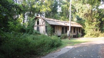
3. Vietnam Training Hut
This building was used to train soldiers during the Vietnam war. It is about 200 feet west of the Battery Clagett.
Credits. This page was last revised on February 5, 2026. It was originally submitted on September 15, 2013, by F. Robby of Baltimore, Maryland. This page has been viewed 785 times since then and 23 times this year. Photos: 1, 2, 3. submitted on September 15, 2013, by F. Robby of Baltimore, Maryland.
