Near Pelican Lake in Oneida County, Wisconsin — The American Midwest (Great Lakes)
Mecikalski Stovewood Building
Photographed by Paul Fehrenbach, September 10, 2013
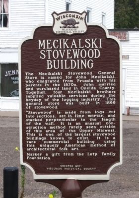
1. Mecikalski Stovewood Building Marker
south side of two sided marker
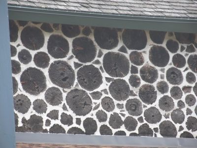
“Stovewood” is made from logs cut into sections, set in lime mortar, and stacked perpendicular to the length of the wall. It is an unusual construction method rarely seen outside of this area of the Upper Midwest. This is one of the largest stovewood buildings known to exist. It is a rare commercial building using this uniquely American method of architectural folk art.
Marker a gift from the Luty Family Foundation.
Erected 2011 by Wisconsin Historical Society. (Marker Number 536.)
Topics and series. This historical marker is listed in these topic lists: Industry & Commerce • Notable Buildings. In addition, it is included in the Wisconsin Historical Society series list. A significant historical year for this entry is 1899.
Location. 45° 30.464′ N, 89° 4.285′ W. Marker
this page online

Regionally, this marker is in Northern Wisconsin. It is also in the American Midwest and in the Corn Belt. Globally, it is in North America, the Great North Woods, the Western Hemisphere, the Western World, and the Anglosphere. Historically, it finds itself in what was once the territory of the Mississippian Culture and also the Northwest Territory.
Other nearby markers. At least 4 other markers are within 15 miles of this marker, measured as the crow flies: Battle of Mole Lake (approx. 5 miles away); Tolling Bell (approx. 7 miles away); Langlade County Forest (approx. 12½ miles away); Old Military Road (approx. 14.6 miles away).
Photographed by Paul Fehrenbach, September 10, 2013
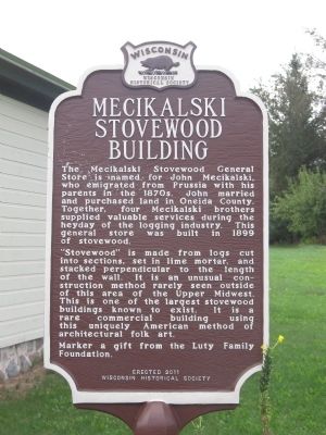
2. Mecikalski Stovewood Building Marker
north side of two sided marker
Photographed by Paul Fehrenbach, September 10, 2013
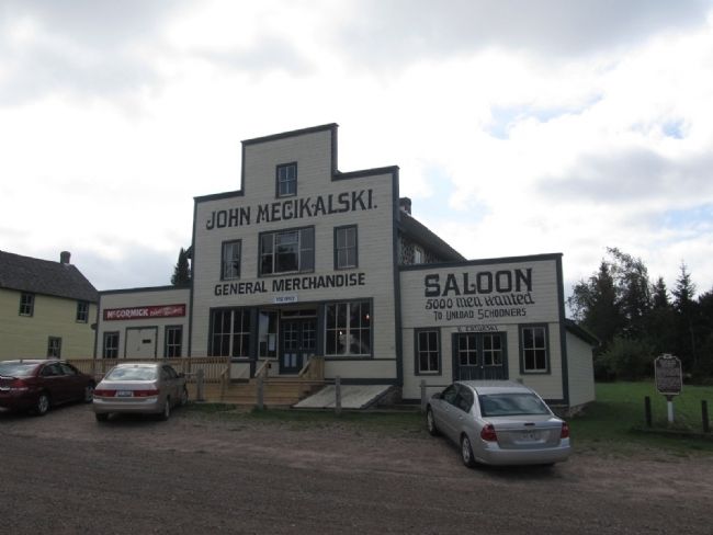
3. Mecikalski Stovewood Building Marker
The marker is to the right of the buildings.
Photographed by Paul Fehrenbach, September 10, 2013
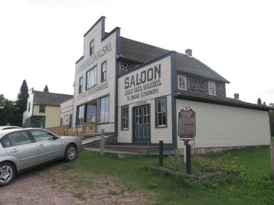
4. Mecikalski Stovewood Building
Stovewood can be seen on the side of building
Photographed by Paul Fehrenbach, September 10, 2013
5. Mecikalski Stovewood Building
Close up of stovewood construction on side of the building
Credits. This page was last revised on March 7, 2021. It was originally submitted on September 16, 2013, by Paul Fehrenbach of Richfield, Wisconsin. This page has been viewed 1,266 times since then and 81 times this year. Photos: 1, 2, 3, 4, 5. submitted on September 16, 2013, by Paul Fehrenbach of Richfield, Wisconsin. • William J. Toman was the editor who published this page.
