Plymouth in Luzerne County, Pennsylvania — The American Northeast (Mid-Atlantic)
Avondale Mine Disaster
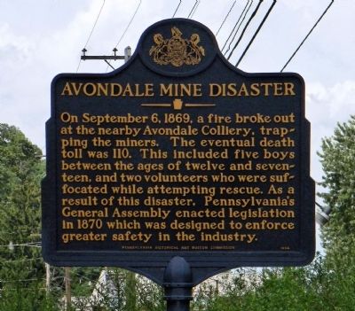
On September 6, 1869, a fire broke out at the nearby Avondale Colliery, trapping the miners. The eventual death toll was 110. This included five boys between the ages of twelve and seventeen, and two volunteers who were suffocated while attempting rescue. As a result of this disaster, Pennsylvania's General Assembly enacted legislation in 1870 which was designed to enforce greater safety in the industry.
Erected 1994 by Pennsylvania Historical and Museum Commission.
Topics and series. This historical marker is listed in these topic lists: Disasters • Industry & Commerce. In addition, it is included in the Pennsylvania Historical and Museum Commission series list. A significant historical month for this entry is September 1964.
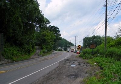
Location. 41° 13.586′ N, 75° 58.472′ W. Marker has been damaged. Marker is in Plymouth, Pennsylvania, in Luzerne County. Marker is on West Main Street (U.S. 11) one mile north of South Cross Valley Expressway (Pennsylvania Route 29), on the right when traveling north. Touch for map. Marker is in this post office area: Plymouth PA 18651, United States of America. Touch for directions.
Other nearby markers. At least 8 other markers are within 2 miles of this location, measured as the crow flies. Abijah Smith & Company (approx. 0.9 miles away); Shawnee Fort (approx. 0.9 miles away); Veterans of Foreign Wars Memorial (approx. 1.2 miles away); Sephaniah Reese (approx. 1.6 miles away); World War I Memorial (approx. 1.6 miles away); 28th Infantry Division Memorial (approx. 1.6 miles away); Vietnam War Memorial (approx. 1.6 miles away); Sergeant Sherwood Baker (approx. 1.6 miles away). Touch for a list and map of all markers in Plymouth.
Related marker. Click here for another marker that is related to this marker.
Also see . . . Andrew Roy's account of the Avondale Disaster. eHistory at OSU website entry (Submitted on September 19, 2013, by PaulwC3 of Northern, Virginia.)
Additional commentary.
1. Marker broken in vehicle crash
This marker was broken at its base in a vehicle crash on January 20th, 2018. The Plymouth Historical Society is hoping to replace the damaged marker.
— Submitted February 1, 2018, by Mark Hilton of Montgomery, Alabama.
2. Marker reinstalled
A Google Earth image dated 11/2022 shows the marker at the given location.
— Submitted January 28, 2023, by Larry Gertner 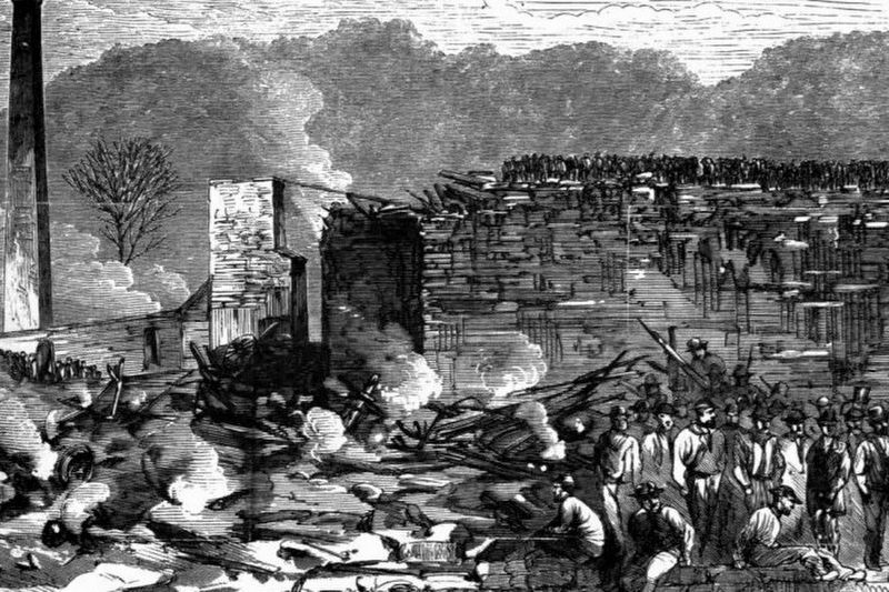 of New York, New York.

Photographed By voa Wynning History, April 3, 2023
2. Avondale Mine Disaster - Rescuers standing in the rubble of the Avondale Colliery’s breaker
Avondale - The Coal Region's Deadliest Mining Disaster
Wynning History website entry:
Click for more information.
Wynning History website entry:
Click for more information.
Credits. This page was last revised on April 3, 2023. It was originally submitted on September 18, 2013, by PaulwC3 of Northern, Virginia. This page has been viewed 821 times since then and 36 times this year. Photos: 1. submitted on September 18, 2013, by PaulwC3 of Northern, Virginia. 2. submitted on April 3, 2023, by Larry Gertner of New York, New York. 3. submitted on April 18, 2016, by Jeffrey Adams of Dallas, Pennsylvania. 4. submitted on September 18, 2013, by PaulwC3 of Northern, Virginia. 5. submitted on April 18, 2016, by Jeffrey Adams of Dallas, Pennsylvania.
Editor’s want-list for this marker. Photos of the Avondale Mine site and Memorial Gardens • Can you help?
