Marker Logo HMdb.org THE HISTORICAL
MARKER DATABASE
“Bite-Size Bits of Local, National, and Global History”
Near Le Sueur in Sibley County, Minnesota — The American Midwest (Upper Plains)
 

1923 Minnesota River Bridge


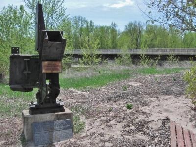
1923 Minnesota River Bridge Marker image. Click for full size.
Photographed By K. Linzmeier, May 16, 2013
1. 1923 Minnesota River Bridge Marker
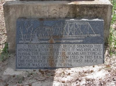
Inscription. Built in 1923 this bridge spanned the Minnesota River here until it was replaced in 1984. The massive steel beams are typical of the truss bridge system used in this era. The 1923 bridge replaced the first bridge which was opened in 1894.
 
Topics. This historical marker is listed in this topic list: Bridges & Viaducts. A significant historical year for this entry is 1923.
 
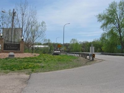
Location. 44° 27.755′ N, 93° 55.088′ W. Marker is near Le Sueur, Minnesota, in Sibley County. Marker is on State Highway 93, 0.2 miles west of State Highway 112, on the right when traveling west. Marker is in River Park. Touch for map. Marker is in this post office area: Le Sueur MN 56058, United States of America. Touch for directions.
 
Other nearby markers. At least 8 other markers are within 5 miles of this marker, measured as the crow flies. Roster of the Le Sueur Tigers (approx. 0.2 miles away); Dr. William W. Mayo House (approx. 0.2 miles away); The Jolly Green Giant (approx. 0.9 miles away); Le Sueur (approx. 1.1 miles away); The Minnesota River Valley (approx. 2.8 miles away); Joseph R. Brown State Monument (approx. 4˝ miles away); St. Jude's Episcopal Church Congregation (approx. 4˝ miles away); Veterans Memorial (approx. 4˝ miles away). Touch for a list and map of all markers in Le Sueur.
 
Also see . . .  MN-93 Bridge. Highways, Byways, And Bridge Photography. "...a funky little
Paid Advertisement
Click on the ad for more information.
Please report objectionable advertising to the Editor.
Click or scan to see
this page online
guard rail sits at an angle to the edge of the bridge to protect the corner of the railroad bridge that extends close to the traffic lane." (Submitted on September 21, 2013.) 
 
1923 Minnesota River Bridge Marker image. Click for full size.
Photographed By K. Linzmeier, May 16, 2013
2. 1923 Minnesota River Bridge Marker
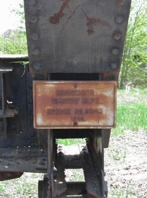
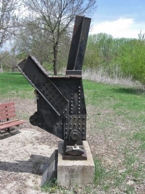
1923 Steel Beams with Bridge Plaque
Bridge Plaque image. Click for full size.
Photographed By K. Linzmeier, May 16, 2013
3. Bridge Plaque
Minnesota Highway Dept., Bridge No. 3945 1923.
1923 Steel Beams image. Click for full size.
Photographed By K. Linzmeier, May 16, 2013
4. 1923 Steel Beams
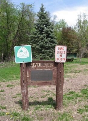
Nearby River Park Sign and Plaque image. Click for full size.
Photographed By K. Linzmeier, May 16, 2013
5. Nearby River Park Sign and Plaque
Close-up of River Park Plaque image. Click for full size.
Photographed By K. Linzmeier, May 16, 2013
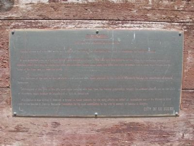
6. Close-up of River Park Plaque
project and funding information
1984 Minnesota River Bridge image. Click for full size.
Photographed By K. Linzmeier, May 16, 2013
7. 1984 Minnesota River Bridge
 
 
Credits. This page was last revised on June 16, 2016. It was originally submitted on September 21, 2013, by Keith L of Wisconsin Rapids, Wisconsin. This page has been viewed 516 times since then and 16 times this year. Photos:   1, 2, 3, 4, 5, 6, 7. submitted on September 21, 2013, by Keith L of Wisconsin Rapids, Wisconsin.
Share this page.  
Share on Tumblr
m=68768

CeraNet Cloud Computing sponsors the Historical Marker Database.
This website earns income from purchases you make after using our links to Amazon.com. We appreciate your support.
Paid Advertisement
Apr. 24, 2024