Near Dewey Beach in Sussex County, Delaware — The American Northeast (Mid-Atlantic)
Standing Guard
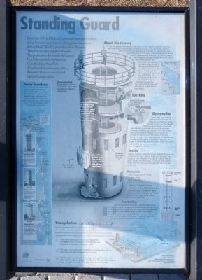
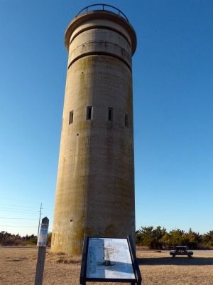
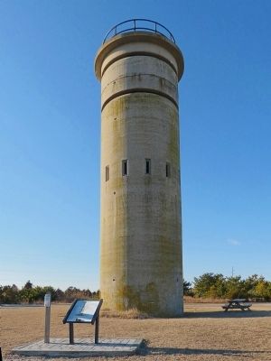
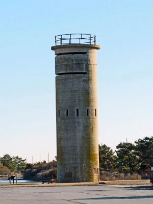
Built from 1939 to 1942, the 11 concrete observation towers along Delaware's coast were built to protect the shores during World War II - and to last about 20 years. They are still standing after 60 years. The towers were the eyes for the guns of Fort Miles, located in what is now Cape Henlopen State Park. Abandoned since the early 1960s, these sentinels once stood guard against German ships.
About the Towers
As war was raging in Europe, the United States saw the need to protect the coast from Nazi naval threats. Delaware Bay was of prime concern. The army quickly built Fort Miles in two years at Cape Henlopen to protect the industrialized and shipbuilding cities of Wilmington and Philadelphia. Fort DuPont and Fort Delaware near Delaware City, and Fort Mott in New Jersey were thought to be too far up the river to be a viable defense. The observation towers along Delaware's coast were part of the overall defense of the coast. They were the spotters for two 16-in guns, two 12-inch guns and four 6-inch guns at Fort Miles. An underwater minefield was also set up from Cape Henlopen to Cape May. Each mine could be turned off electronically to allow friendly ships to pass.
Tower locations
Thirteen observation towers were built to protect the entrance to Delaware Bay. Eleven are along Delaware beaches from Fenwick Island to Cape Henlopen. Two towers, numbers 9 and 11, are located near Cape May, New Jersey and Tower 7 in Cape Helopen State Park has been renovated.
Gordon Pond
The two towers near Gordons Pond are being hit by waves at high tide.
Tower 7
The observatory
This 75-foot tower was repaired and is open to the public. A spiral staircase in its interior replaced the ladder.
Tower 4
Dewey Beach
Two towers still stand off Tower Road in Delaware Seashore State Park south of Dewey Beach.
Tower 1
Below the inlet
Two smaller, 40-foot towers, one near the Cotton Patch Hills development and the other in Fenwick Island State Park.
Observation
Towers were equipped with various optical instruments for acquiring and observing targets. The most common was the azimuth sighting range finder. The range finder were mounted on concreted columns inside the towers positioned to see through the tower's slits. These scopes were used to determine the position of a target. an azimuth is a measure along the horizon of the angle between an object and a reference point. An observer and a reader worked together to determine the azimuth of a target. The coordinates obtained with the scope were sent to a base station bunker or a gun battery (see "Triangulation" below).
Inside
Soldiers climbed a ladder through the center of the tower that reached all the way to the top. At the time, the towers were equipped with wooden floors and glass windows. After 60 years, only the concrete remains. The towers were heated in winter. Each floor was large enough to hold four to six men comfortably.
Dimensions
• Height: Ranges from 39-75 feetThe towers range in height from about 39 feet near Fenwick Island to the 75-foot observation tower open to the public at Cape Henlopen State Park.
• Diameter: 16 feet
• Walls: 1 foot thick
• Built: Continuous-flow concrete structure
• Heat: 440-volt electric heaters
• Cost: Tower 12 cost $29,500 to build
Construction
The foundation is a series of 14 creosole-coated pilings that were hammered into the sand. A concrete base was laid on top and then the tower was built. They are constructed from reinforced concrete. Wire mesh and steel reinforcing bars were used for strengthening. Concrete was poured into a form in a continuous stream, which took about 24 hours to complete. Although built to last only 20 years, the towers still stand after 60.
Triangulation: Targeting the enemy
Contrary to popular belief, the towers were not built to shoot German ships and submarines but to sight enemy warships off the coast. They were not equipped with weapons. The towers were built at specific sites and the distances between them determined. Once a ship was sighted, observers took azimuth readings every 30 seconds and relied on a simple math triangulation method.
❶ Once a ship was sighted, in this case by Tower A and Tower B, the coordinates of their sightlines were telephoned to the battery commander station.
❷ The battery commander station plotted the coordinates along with the known base-line distance between the two towers.
❸ Together, the three lines created a triangle, which could then be used to determine the angle and direction of artillery file. The guns of Fort Miles on Cape Henlopen were never called upon to fire at an enemy ship.
Erected by Delaware State Parks; The News Journal.
Topics and series. This historical marker is listed in these topic lists: Communications • Forts and Castles • War, World II • Waterways & Vessels. In addition, it is included in the Delaware State Parks series list. A significant historical year for this entry is 1939.
Location. 38° 40.684′ N, 75° 4.263′ W. Marker is near Dewey Beach, Delaware, in Sussex County. Marker is on Coastal Highway. This Marker is at Tower Road Beach along the Coastal Highway. Touch for map. Marker is at or near this postal address: 39036 Towers Rd, Rehoboth Beach DE 19971, United States of America. Touch for directions.
Other nearby markers. At least 8 other markers are within 3 miles of this marker, measured as the crow flies. History of Lake Comegys and Silver Lake (approx. 2.1 miles away); World War I Memorial (approx. 2˝ miles away); Funland (approx. 2˝ miles away); The Anna Hazzard House (approx. 2.7 miles away); The Bandstand (approx. 2.7 miles away); City of Rehoboth Beach (approx. 2.7 miles away); Veterans Memorial (approx. 2.7 miles away); Rehoboth Beach Public Library (approx. 2.7 miles away).
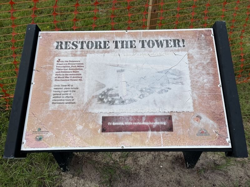
More about this marker. This marker is identical to marker #39595 in Lewes but it's much more faded. This is Tower #3.
Photographed By Devry Becker Jones (CC0), June 3, 2022
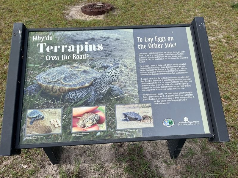
6. Additional plaque nearby about stewardship of terrapins
Credits. This page was last revised on September 18, 2023. It was originally submitted on September 29, 2013, by Allen C. Browne of Silver Spring, Maryland. This page has been viewed 684 times since then and 32 times this year. Photos: 1, 2, 3, 4. submitted on September 29, 2013, by Allen C. Browne of Silver Spring, Maryland. 5, 6. submitted on June 4, 2022, by Devry Becker Jones of Washington, District of Columbia. • Bill Pfingsten was the editor who published this page.
