Near Holbrook in Navajo County, Arizona — The American Mountains (Southwest)
A Gap in the Geologic Record
Inscription.
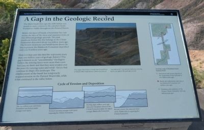
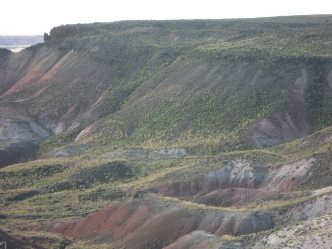
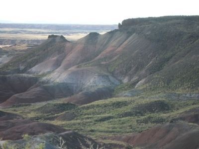
The black basalt that caps the cliffs before you stands in stark contrast to the colorful Chinle Formation visible throughout the Painted Desert.
Below this layer of basalt, a horizontal line cuts across the face of the mesa and separates rocks of two different geologic periods. The pink mudstone below this line belongs to the Chinle Formation deposited about 225 million years ago. The brown mudstone and basalt layers above the line represent the Bidahochi Formation deposited only 5 to 8 million years ago.
How is it that only this thin line represents more than 200 million years of geologic history? This gap is known as an "unconformity." Geologists believe the missing layers were more than 1,000 feet (305 m) thick and that they were eroded over the years by running water and wind - forces that continue to shape this landscape. The emplacement of the basalt has temporarily stopped erosion on the Painted Desert rim, while it has continued in the valley below.
Erected by National Park Service, U.S. Department of the Interior.
Topics. This historical marker is listed in these topic lists: Natural Features • Notable Places.
Location. 35° 4.14′ N, 109° 47.677′ W. Marker is near Holbrook, Arizona, in Navajo County. Marker is on Petrified Forest Road, on the left when traveling east. Touch for map. Marker is at or near this postal address: Petrified Forest Road, Holbrook AZ 86025, United States of America. Touch for directions.
Other nearby markers. At least 8 other markers are within 2 miles of this marker, measured as the crow flies. Early Explorers (approx. ¼ mile away); The Painted Desert (approx. 0.6 miles away); Painted Desert Community Complex Historic District (approx. ¾ mile away); A Painted Park (approx. 0.8 miles away); Desert Vistas (approx. one mile away); Over the Edge (approx. one mile away); Painted Desert Inn (approx. 1.1 miles away); Badlands (approx. 1.1 miles away). Touch for a list and map of all markers in Holbrook.

Photographed By Denise Boose, September 2, 2013
4. Cycle of Erosion and Deposition
First graphic: The 225-million-year-old Chinle Formation was buried under younger rock layers.
Second graphic: Erosion cut away younger rock layers exposing the Chinle Formation.
Third graphic: Starting eight million years ago, lakes and volcanoes reburied the Chinle Formation under the much younger Bidahochi Formation.
Fourth graphic: Recent erosion has removed most of the Bidahochi, re-exposing the Chinle Formation.
Credits. This page was last revised on June 16, 2016. It was originally submitted on September 29, 2013, by Denise Boose of Tehachapi, California. This page has been viewed 713 times since then and 30 times this year. Photos: 1, 2, 3, 4, 5, 6, 7, 8. submitted on September 29, 2013, by Denise Boose of Tehachapi, California. • William J. Toman was the editor who published this page.
