Santa Clara in Santa Clara County, California — The American West (Pacific Coastal)
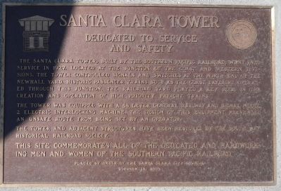
Santa Clara Tower
Dedicated to Service and Safety
The tower was equipped with a 48 lever General Railway and Signal Model 2 electric interlocking machine. The design of this equipment prevented an unsafe route from being set by an operator.
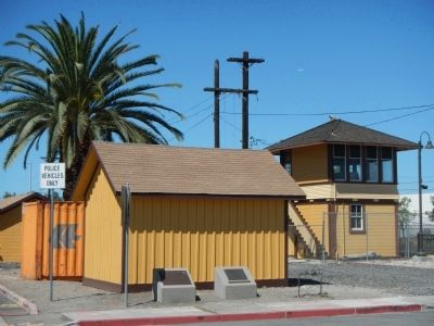
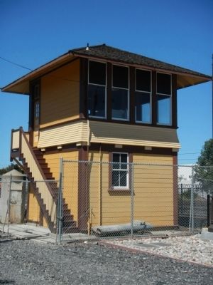
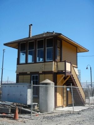
The tower and adjacent structures have been restored by the South Bay Historical Railway Society.
This site commemorates all of the dedicated and hardworking men and women of the Southern Pacific Railroad.
October 12, 2002
Erected 2002 by Santa Clara City Council.
Topics. This historical marker is listed in this topic list: Railroads & Streetcars. A significant historical month for this entry is October 1908.
Location. 37° 21.224′ N, 121° 56.266′ W. Marker is in Santa Clara, California, in Santa Clara County. Marker is at the intersection of Benton Street and Railroad Avenue, on the left when traveling north on Benton Street. Touch for map. Marker is at or near this postal address: 471 Benton Street, Santa Clara CA 95050, United States of America. Touch for directions.
Other nearby markers. At least 8 other markers are within walking distance of this marker. The Santa Clara Interlocking Control Tower (here, next to this marker); Santa Clara Depot (about 400 feet away, measured in a direct line); a different marker also named Santa Clara Depot (about 600 feet away); Santa Clara Mission (about 600 feet away); Santa Clara Women’s Club Adobe (approx. 0.2 miles away); Mission Santa Clara (approx. 0.3 miles away); The Changing Church (approx. 0.3 miles away); The Five Sites of Santa Clara de Asís Mission (approx. 0.3 miles away). Touch for a list and map of all markers in Santa Clara.
Credits. This page was last revised on June 16, 2016. It was originally submitted on September 30, 2013, by Barry Swackhamer of Brentwood, California. This page has been viewed 416 times since then and 7 times this year. Photos: 1, 2, 3, 4. submitted on September 30, 2013, by Barry Swackhamer of Brentwood, California. • Andrew Ruppenstein was the editor who published this page.


