Pulaski in Williams County, Ohio — The American Midwest (Great Lakes)
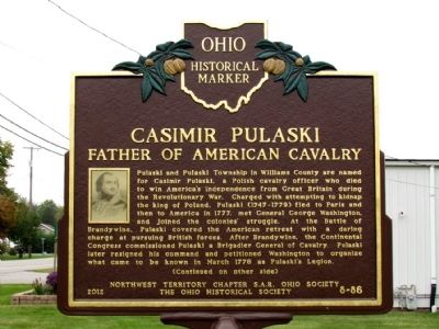
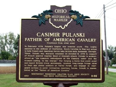
Casimir Pulaski
Father of American Cavalry
(Side One)
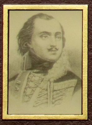
Pulaski and Pulaski Township in Williams County are named for Casimir Pulaski, a Polish cavalry officer who died to win America's independence from Great Britain during the Revolutionary War. Charged with attempting to kidnap the king of Poland, Pulaski (1747-1779) fled to Paris and then to America in 1777, met General George Washington, and joined the colonies' struggle. At the Battle of Brandywine, Pulaski covered the American retreat with a daring charge at pursuing British forces. After Brandywine, the Continental Congress commissioned Pulaski a Brigadier General of Cavalry. Pulaski later resigned his command and petitioned Washington to organize what came to be known in March 1778 as Pulaski's Legion.
(Side Two)
In February 1779, Pulaski's Legion was ordered south. The Legioin assisted in the defense of Charleston, South Carolina in May and moved to help French and American forces take British-held Savannah, Georgia. There, Pulaski was mortally wounded on October 9, 1779 in support of French admiral Charles Henri d' Estaing's attack. Pulaski is memorialized as "the romantic embodiment of the flashing saber and the trumpet calling 'to the charge'." For forging a force that could scout and report British troop movements, conduct long-range forage raids to feed and clothe soldiers at Valley Forge, and engage in rearguard actions to cover retreating American forces, Pulaski is remembered as the "Father of American Cavalry."
Erected 2012 by Northwest Territory Chapter S.A.R. Ohio Society and the Ohio Historical Society. (Marker Number 8-86.)
Topics and series. This historical marker is listed in this topic list: War, US Revolutionary. In addition, it is included in the Ohio Historical Society / The Ohio History Connection, and the Sons of the American Revolution (SAR) series lists. A significant historical month for this entry is February 1779.
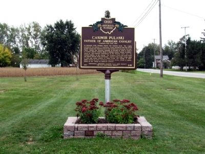
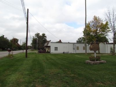
Location. 41° 30.561′ N, 84° 30.452′ W. Marker is in Pulaski, Ohio, in Williams County. Marker is at the intersection of High Street (U.S. 127) and Poplar Street, on the right when traveling north on High Street. Marker is located south of the Pulaski Township Hall. Touch for map. Marker is at or near this postal address: 6646 High Street, Bryan OH 43506, United States of America. Touch for directions.
Other nearby markers. At least 8 other markers are within 4 miles of this marker, measured as the crow flies. Judge John Perkins Millstones (approx. 0.3 miles away); Shiffler Cemetery Veterans Memorial (approx. 1.6 miles away); Pulaski Mothers of World War II Memorial (approx. 1.7 miles away); Veterans Memorial (approx. 1.7 miles away); Site of Parkersburg (approx. 2.6 miles away); Bryan's Air Mail Field (approx. 2.9 miles away); Rail Speed Record (approx. 3.1 miles away); Evans Post No. 149 G.A.R. (approx. 3.3 miles away). Touch for a list and map of all markers in Pulaski.
Also see . . . Casimir Pulaski - Wikipedia Entry. (Submitted on October 5, 2013.)
Credits. This page was last revised on June 16, 2016. It was originally submitted on October 5, 2013, by Duane Hall of Abilene, Texas. This page has been viewed 1,137 times since then and 53 times this year. Photos: 1, 2, 3, 4, 5. submitted on October 5, 2013, by Duane Hall of Abilene, Texas.
