Garretson in Minnehaha County, South Dakota — The American Midwest (Upper Plains)
Garretson
Photographed by Roger Dean Meyer, October 6, 2008
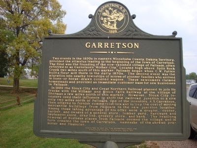
1. Garretson Marker (Side One)
In 1889 the Sioux City and Great Northern Railroad planned to join its tracks with the Willmar and Sioux Falls Railway at the village of Sherman a few miles north of this marker. However, Sioux City investors used their influence to shift the railroad junction to a site only two miles north of Palisade. One of the investors, A.S. Garretson, then offered to furnish commercial lots and to pay the cost of moving mercantile buildings from Palisade to the new junction location.
this page online
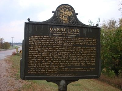
A quartzite stone quarry opened in the early 1890’s and provided material for several impressive Garretson buildings, including two banks, an opera house, and general and department stores. By 1915 city fathers boasted that a cigar factory and the elegant Grand Hotel were among the 63 businesses in Garretson.
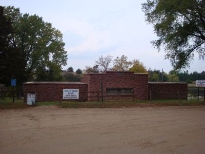
Continuing to attract residents and tourists today are three parks that feature Sioux quartzite outcroppings. Split Rock Park began as a Works Project Administration project in the 1930’s. Three attractive quartzite structures were constructed: a dam, a bathhouse, and a picturesque bridge. Devil’s Gulch Park is the site of both prehistoric and historic tales and legends. Dakota Indians called the quartzite canyon “Spirit Canyon” and
Photographed by Roger Dean Meyer, October 6, 2008
2. Garretson Marker (Side 2)
Now in its second century, the town of Garretson is a vibrant community with a promising future and a second economy and is a regional tourist destination.
Erected 2001 by Garretson Area and Minnehaha County Historical Societies.
Topics. This historical marker is listed in this topic list: Settlements & Settlers. A significant historical year for this entry is 1889.
Location. 43° 43.131′ N, 96° 30.261′ W. Marker is in Garretson, South Dakota, in Minnehaha County. It is on 5th Street (Local Route 5th) ¼ mile west of Main Street, on the right when traveling west. Touch for map. Marker is in this post office area: Garretson SD 57030, United States of America. Touch for directions.

Regionally, this marker is in the Yankton Sioux Tribe, in East River, and in Greater Sioux Falls. It is also in the American Midwest,
Photographed by Roger Dean Meyer, October 6, 2008
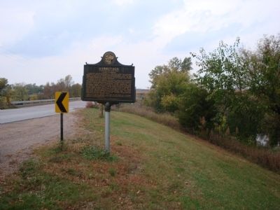
3. Garretson Marker From a Distance
Other nearby markers. At least 8 other markers are within 5 miles of this marker, measured as the crow flies: Festival of Progress (approx. ¼ mile away); The Legend of Jesse James (approx. half a mile away); 1908 Palisades Bridge (approx. 2.2 miles away); Village of Palisades (approx. 2.3 miles away); Palisades State Park (approx. 2.4 miles away); Norway Lutheran Church (approx. 4.4 miles away); Eleven Original Pioneer Families (approx. 4.4 miles away); a different marker also named Norway Lutheran Church (approx. 4.4 miles away). Touch for a list and map of all markers in Garretson.
Photographed by Roger Dean Meyer, October 6, 2008
4. Quartzite Bathhouse
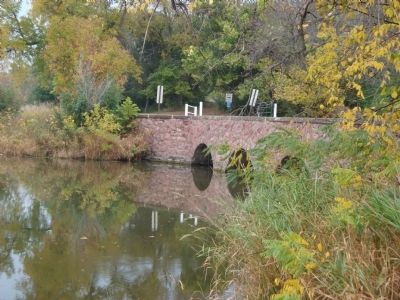
Photographed by Roger Dean Meyer, October 6, 2008
5. Quartzite Bridge
Credits. This page was last revised on October 22, 2020. It was originally submitted on October 6, 2013, by Roger Dean Meyer of Yankton, South Dakota. This page has been viewed 1,202 times since then and 69 times this year. Photos: 1, 2, 3, 4, 5. submitted on October 6, 2013, by Roger Dean Meyer of Yankton, South Dakota.
