Wissahickon Valley Park in Philadelphia in Philadelphia County, Pennsylvania — The American Northeast (Mid-Atlantic)
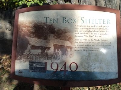
Ten Box Shelter
1940
A telephone line used by park guards once ran along Forbidden Drive. The line had ten locked phone boxes, the tenth one here. The line is gone, but the name “Ten Box” lives on.
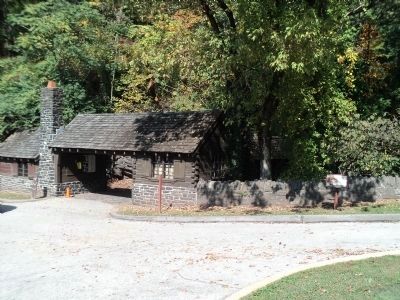
Built in 1940 by the Works Progress Administration (WPA), Ten Box served as a guard station and provided visitors with restrooms. The storage room once hosted a bicycle concession.
In the 1990s, the Friends of the Wissahickon restored Ten Box and other WPA buildings in the park.
Topics and series. This historical marker is listed in these topic lists: Charity & Public Work • Notable Buildings. In addition, it is included in the Works Progress Administration (WPA) projects series list. A significant historical year for this entry is 1940.
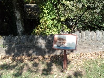
Location. 40° 1.656′ N, 75° 11.563′ W. Marker is in Philadelphia, Pennsylvania, in Philadelphia County. It is in Wissahickon Valley Park. Marker is at the intersection of Lincoln Drive and Forbidden Drive, on the right when traveling south on Lincoln Drive. Marker is located in parking area 12 of Wissahickon Valley Park at Lincoln and Forbidden Drive. Touch for map. Marker is at or near this postal address: 6259 Forbidden Dr, Philadelphia PA 19144, United States of America. Touch for directions.
Other nearby markers. At least 8 other markers are within walking distance of this marker. Battle of Germantown (a few steps from this marker); Forbidden Drive (within shouting distance of this marker); a different marker also named Battle of Germantown (approx. 0.2 miles away); The Jacob Rittenhouse Home at RittenhouseTown (approx. 0.2 miles away); Rittenhouse Town (approx. 0.2 miles away); David Rittenhouse (approx. 0.2 miles away); Rittenhouse Homestead (approx. 0.2 miles away); Colonial Herb Garden (approx. 0.2 miles away). Touch for a list and map of all markers in Philadelphia.
More about this marker. The background of the marker contains a photo of the Ten Box Shelter when it serves as a bicycle concession.
Credits. This page was last revised on February 2, 2024. It was originally submitted on October 6, 2013, by Bill Coughlin of Woodland Park, New Jersey. This page has been viewed 711 times since then and 31 times this year. Photos: 1, 2, 3. submitted on October 6, 2013, by Bill Coughlin of Woodland Park, New Jersey.


