Michigan Bluff in Placer County, California — The American West (Pacific Coastal)
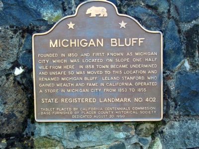
Michigan Bluff
State Registered Landmark No. 402
Tablet placed by California Centennials Commission. Base furnished by Placer County Historical Society
Dedicated August 20, 1950
Erected 1950 by California Centennials Commission. (Marker Number 402.)
Topics and series. This historical marker is listed in these topic lists: Industry & Commerce • Settlements & Settlers. In addition, it is included in the California Historical Landmarks series list. A significant historical year for this entry is 1850.
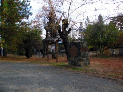
Location. 39° 2.509′ N, 120° 44.209′ W. Marker is in Michigan Bluff, California, in Placer County. Marker is at the intersection of Michigan Bluff Road (Route 402) and Church Street, on the right when traveling east on Michigan Bluff Road. Touch for map. Marker is in this post office area: Foresthill CA 95631, United States of America. Touch for directions.
Other nearby markers. At least 5 other markers are within 5 miles of this marker, measured as the crow flies. Michigan Bluff to Last Chance (about 600 feet away, measured in a direct line); Pioneers of Deadwood (approx. 3.7 miles away); St. Joseph’s Catholic Church Bell (approx. 4.2 miles away); Foresthill School Bell (approx. 4.3 miles away); Foresthill Protestant Cemetery (approx. 4.3 miles away).
Credits. This page was last revised on November 7, 2019. It was originally submitted on November 15, 2006, by Karen Key of Sacramento, California. This page has been viewed 2,240 times since then and 13 times this year. Photos: 1, 2. submitted on November 15, 2006, by Karen Key of Sacramento, California. • J. J. Prats was the editor who published this page.

