Murfreesboro in Rutherford County, Tennessee — The American South (East South Central)
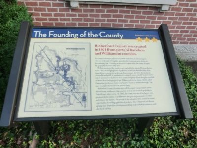
The Founding of the County
The first meeting of the county court was held at the home of Thomas Rucker, and in 1805, the fledgling town of Jefferson, located just above the forks of the Stones River, was selected as the seat of government. By 1811, the decline in river traffic and a shift in population necessitated a more centrally-located county seat. A commission of citizens chose a sixty-acre piece of land along the west fork of Stones River belonging to Capt. William Lytle for the honor. Briefly called Cannonsburgh, the new town soon become known as Murfreesborough. The name was later shortened to its present form.
Rutherford County’s location and well-developed transportation system allowed many residents to ship a variety of crops and livestock profitably to Nashville and other towns. By 1840, the county was one of the largest corn producers in the nation. Local farmers also grew large amounts of cotton and tobacco for market. The arrival of the railroad in 1851 created increased opportunities for selling agricultural products. The widespread and diverse agrarian base limited the development of large-scale industrial endeavors until after the Civil War.
Erected by Rutherford County Tennessee.
Topics. This historical marker is listed in this topic list: Settlements & Settlers. A significant historical year for this entry is 1803.
Location. 35° 50.771′ N, 86° 23.515′ W. Marker is in Murfreesboro, Tennessee, in Rutherford County. Marker is on North Public Square west of North Church Street. Located on the North side of the Public Square. Touch for map. Marker is in this post office area: Murfreesboro TN 37130, United States of America. Touch for directions.
Other nearby markers. At least 8 other markers are within walking distance of this marker. Original Courthouse Step (a few steps from this marker); Rutherford County Courthouse (a few steps from this marker); Rutherford County Boys (a few steps from this marker); Gen. Nathan Bedford Forrest Memorial (a few steps from this marker); Murfreesboro was the Capital of the State of Tennessee (within shouting distance of this marker); Federal Troops on the Square (within shouting distance of this marker); Murfreesboro Confederate Soldiers Monument (within shouting distance of this marker); General Griffith Rutherford (within shouting distance of this marker). Touch for a list and map of all markers in Murfreesboro.
Credits. This page was last revised on November 27, 2018. It was originally submitted on October 8, 2013, by Don Morfe of Baltimore, Maryland. This page has been viewed 417 times since then and 8 times this year. Photos: 1, 2. submitted on October 8, 2013, by Don Morfe of Baltimore, Maryland. • Al Wolf was the editor who published this page.

