Near Red Cliff in Eagle County, Colorado — The American Mountains (Southwest)
Construction of Camp Hale
10th Mountain Division
— U.S. Army —
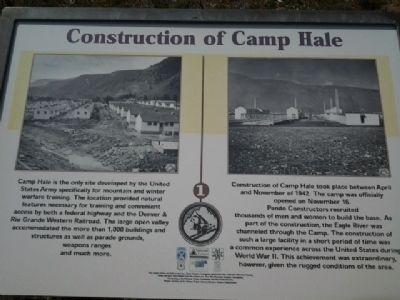
Construction of Camp Hale took place between April and November of 1942. The camp was officially opened on November 16. Pando Constructors recruited thousands of men and women to build the base. As part of the construction, the Eagle River was channeled through the Camp. The construction of such a large facility in a short period of time was a common experience across the United States during World War II. This achievement was extraordinary however, given the rugged conditions of the area. (Marker Number 1.)
Topics. This historical marker is listed in this topic list: War, World II. A significant historical month for this entry is November 1942.
Location. 39° 26.168′ N, 106° 19.32′ W. Marker is near Red Cliff, Colorado, in Eagle County. Marker is on Camp Hale 1 (U.S. 24) near Camp Hale Spur 1B, on the left when traveling south. The site is approximately 8 miles South of Red Cliff, CO and 16 miles North of Leadville, CO on the East side of US 24. Touch for map. Marker is in this post office area: Red Cliff CO 81649, United States of America. Touch for directions.
Other nearby markers. At least 8 other markers are within 9 miles of this marker, measured as the crow flies. Norwegian Memorial (approx. 5.2 miles away); Office of Strategic Services (O.S.S.) NORSO (Rype Group) Special Force (approx. 5.2 miles away); 10th Mountain Division Memorial (approx. 5.2 miles away); Kokomo Masonic Lodge (approx. 7.7 miles away); Vail / Vail Pass Country (approx. 8.4 miles away); Mount of the Holy Cross (approx. 8.4 miles away); 10th Mountain Division (approx. 8.4 miles away); Fremont Pass (approx. 8˝ miles away).
More about this marker. This marker is located in a set of 3 historical markers about Camp Hale.
Regarding Construction of Camp Hale. The markers are visible from US Highway 24 on the East side.
Credits. This page was last revised on July 21, 2017. It was originally submitted on August 24, 2013, by Dan Peterson of Glen Allen, Virginia. This page has been viewed 1,163 times since then and 29 times this year. Last updated on October 9, 2013, by Dan Peterson of Glen Allen, Virginia. Photo 1. submitted on August 24, 2013, by Dan Peterson of Glen Allen, Virginia. • Bill Pfingsten was the editor who published this page.
Editor’s want-list for this marker. A wide shot of the marker and its surroundings. • Can you help?
