Tiburon in Marin County, California — The American West (Pacific Coastal)
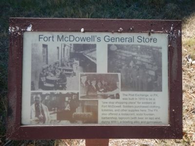
Fort McDowell’s General Store
Photographed by Barry Swackhamer, October 3, 2013
1. Fort McDowell’s General Store Marker
Topics. This historical marker is listed in these topic lists: Forts and Castles • Military. A significant historical year for this entry is 1910.
Location. 37° 51.748′ N, 122° 25.304′ W. Marker is in Tiburon, California, in Marin County. It can be reached from Perimeter Road. Touch for map. Marker is in this post office area: Belvedere Tiburon CA 94920, United States of America. Touch for directions.

Regionally, this marker is in the San Francisco Bay Area, in the North Coast, and specifically on the Coast Ranges. It is also on the American Pacific Coast. Globally, it is in North America, on the Ring of Fire, on the Pacific Rim, in the Western Hemisphere, in the Western World, and in the Anglosphere. Historically, it finds itself in what was once New Spain and also Mexico’s Alta
this page online
Other nearby markers. At least 8 other markers are within walking distance of this marker: 600 Bunkmates (within shouting distance of this marker); Over 12,000 Meals a Day Served (within shouting distance of this marker); Guarding the Post (within shouting distance of this marker); Processing People and Paper (within shouting distance of this marker); Bowling and Dollars (about 300 feet away); Ministering to all Faiths (about 300 feet away); Treating the Troops (about 400 feet away); Supplying the Troops (about 500 feet away). Touch for a list and map of all markers in Tiburon.
Another marker is no longer nearby. Shipping Out and Coming Home (was about 300 feet away, measured in a direct line but has been permanently removed).
Regarding Fort McDowell’s General Store. Angel Island State Park is accessed by ferry from Tiburon. Perimeter Road is a 5 mile, mostly paved, walking/bicycle path that goes around Angel Island. This marker is located at Fort McDowell.
Also see . . . Historic American Buildings Survey Record for Fort McDowell. (Submitted on October 14, 2013.)
Photographed by Barry Swackhamer, October 3, 2013
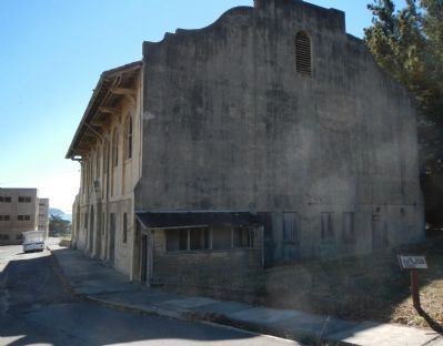
2. Fort McDowell’s General Store Marker
HABS Statement of Signicance: The growth of the U.S. military in the early twentieth century precipitated expansion of the Army presence on Angel Island. After nearly forty years of maintaining a modest Army installation at Camp Reynolds on the west side of the island, development and resources were shifted to a new location on the east. Initially a quarry and outpost of Fort McDowell, this site was used for a variety of administrative purposes relating to the enlistment, assignment, movement, and discharge of troops until the base was decommissioned in 1946. As it still exists, the East Garrison features a remarkable collection of Army architecture from the early twentieth century.... (Continued next photo.)
James W. Rosenthal (Historic American Buildings Survey), 2002
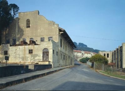
3. Fort McDowell - Post Exchange (General Store), Hospital, Mess & Drill Hall
(Statement of Signicance, continued)...A major building campaign of reinforced concrete Mission Revival structures begun in 1910 gave this important recruit depot a cohesive aesthetic that reflected the new importance of planning in Army construction. Additional wood structures dating to both before and after this campaign illustrate the variety of architecture and functions at an Army post.
Photographed by Joseph Alvarado, July 30, 2022
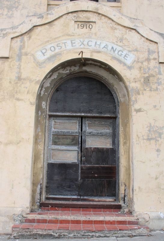
4. Front door of the Post Exchange
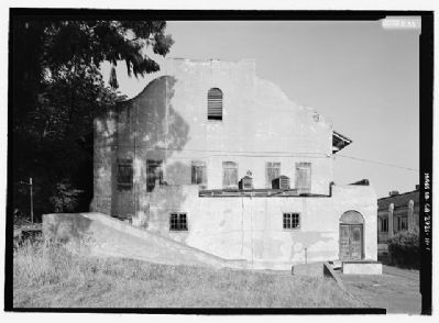
Library of Congress, circa 1930's
5. The Post Exchange
Library of Congress HABS CAL,21-ANGEL,2H--1
Credits. This page was last revised on August 29, 2022. It was originally submitted on October 13, 2013, by Barry Swackhamer of Brentwood, California. This page has been viewed 813 times since then and 52 times this year. Photos: 1, 2. submitted on October 13, 2013, by Barry Swackhamer of Brentwood, California. 3. submitted on October 14, 2013. 4. submitted on August 11, 2022, by Joseph Alvarado of Livermore, California. 5. submitted on October 18, 2013. • Syd Whittle was the editor who published this page.
