Union in Union County, New Jersey — The American Northeast (Mid-Atlantic)
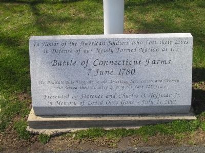
Battle of Connecticut Farms
7 June 1780
in defense of our newly formed nation at the
Battle of Connecticut Farms
7 June 1780
We dedicate this flagpole to all American Servicemen and Women
who served their country during the last 225 years
Presented by Florence and Charles O. Hoffman Jr.
in Memory of Loved Ones gone – June 21, 2001
Erected 2001 by Florence and Charles O. Hoffman Jr.
Topics. This historical marker is listed in these topic lists: Military • War, US Revolutionary. A significant historical date for this entry is June 7, 1780.
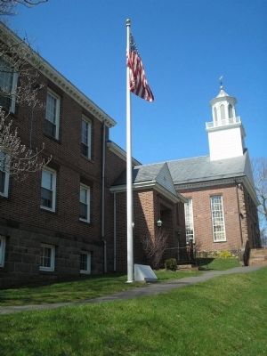
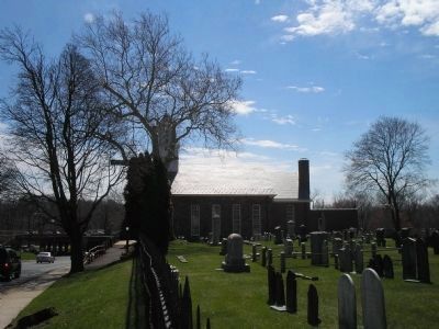
Location. 40° 41.548′ N, 74° 16.387′ W. Marker is in Union, New Jersey, in Union County. Marker is at the intersection of Stuyvesant Avenue and Chestnut Street, on the right when traveling south on Stuyvesant Avenue. Monument is in front of the Connecticut Farms Presbyterian Church. Touch for map. Marker is in this post office area: Union NJ 07083, United States of America. Touch for directions.
Other nearby markers. At least 8 other markers are within walking distance of this marker. Connecticut Farms (here, next to this marker); First Presbyterian Church of Connecticut Farms (here, next to this marker); Washington’s Headquarters (a few steps from this marker); Revolutionary Soldiers (within shouting distance of this marker); Mass Grave of British and Hessian Troops (about 500 feet away, measured in a direct line); Pearl Harbor Square (approx. 0.2 miles away); Jahn's Restaurant & Ice Cream Parlor (approx. ¼ mile away); Caldwell’s Home (approx. 0.4 miles away). Touch for a list and map of all markers in Union.
Also see . . . The Battles of Connecticut Farms and Springfield. (Submitted on April 6, 2008, by Bill Coughlin of Woodland Park, New Jersey.)
Credits. This page was last revised on June 16, 2016. It was originally submitted on April 6, 2008, by Bill Coughlin of Woodland Park, New Jersey. This page has been viewed 2,238 times since then and 17 times this year. Photos: 1, 2, 3. submitted on April 6, 2008, by Bill Coughlin of Woodland Park, New Jersey. • Craig Swain was the editor who published this page.


