Centerville in Wayne County, Indiana — The American Midwest (Great Lakes)
Pike Towns
Historic National Road / Make History, Drive It
— The Road That Built The Nation —
Inscription.
(Side One)
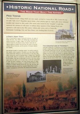
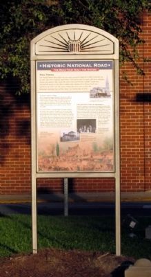
The National Road--along which you now stand—arrived here in Centerville in 1832. Centerville was an early "pike town". Regularly spaced about a day's journey apart by wagon, pike towns welcomed travelers and catered to their needs. Pike towns were named for the "turnpike" or pole that restricted the entrance to toll roads. In Indiana many segments of the National Road were operated as toll roads in the early 19th century. Indiana pike towns, such as Centerville, Richmond, Cambridge City, and Terre Haute, were bustling hubs of activity.
A Dusty, Noisy Town
Here in Centerville the ringing of blacksmith hammers, the clatter of horses and oxen, noisy children, and barking dogs accompanied the endless procession of wagons, stages, and coaches. Above the din could be heard the discussions of busy Hoosiers mixed with the regional dialects of travelers from the East, the voices of free and enslaved African Americans, and the accents of European laborers and travelers.
Not everyone traveled in Conestoga wagons. The wealthy traveled in fine coaches, others traveled on horseback, and many simply walked. Some arrived with nothing but a few possessions on their back while others arrived with scores of bleating sheep or foraging hogs. Regardless of their wealth, status, or conveyance, a pike town was a welcome sight for all travelers. Here was an opportunity to rest for a few hours, have a warm meal, and catch up on the latest news. It was also a good place to settle and open a business—and many Hoosiers grew rich selling supplies, offering accommodations, or repairing broken wheels for the hundreds of travelers passing through town each day. Over time, pike towns like Centerville evolved from essential National Road "service centers" to prosperous communities with diverse local economies.
The Architecture of Prosperity
Centerville's architecture is a testament to the wealth the National Road brought to Indiana. Many of the brick and stone buildings are evocative of the fashionable Federal style of the day. Their quality materials and design speak to the town's enviable economic position between the growing markets of the East and the raw materials and agricultural bounty of the West. They stand as solid reminders of Centerville's prosperity during the heyday of the National Road (1830-1850). The Mansion House, a popular stage stop and the home of Daniel Lantz, a prominent wagon-maker, are just a few steps away. Over 100 of Centerville's buildings are listed in the National Register of Historic Places.
(Upper Right Drawing Caption)
A hay wagon passing Merideth House, a stagecoach stop on the National Road in Richmond,
Indiana.
(Lower Left Drawing Caption)
The Blacksmith's Shop
Rough road conditions were hard on vehicles and horses. Blacksmiths were in high demand to make essential repairs.
(Lower Center Photo Caption)
Paying the Toll
The Old Petersburg/Addison tollhouse in Pennsylvania stands as one of the few remaining tollhouses along the entire National Road. Like modern turnpikes, travelers paid tolls to continue their journey.
(Lower Drawing Caption)
A Busy Highway
Pike towns and taverns along the National Road were crowded with emigrants and travelers navigating the busy highway.
(Side Two)
Make History, Drive It
The Road That Built The Nation
The Auto Age
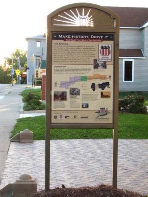
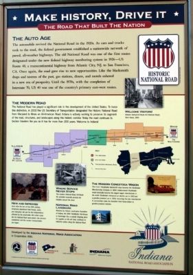
The automobile revived the National Road in the 1920s. As cars and trucks took to the road, the federal government established a nationwide network of paved, all-weather highways. The old National Road was one of the first routes designated under the new federal highway numbering system in 1926—US Route 40, a transcontinental highway from Atlantic City, NJ, to San Francisco, CA. Once again, the road gave rise to new opportunities. Like the blacksmith shops and taverns of the past, gas stations, diners, and motels ushered in a new era of prosperity. Until the 1970s, with
the completion of Interstate 70, US 40 was one of the country's primary east-west routes.
The Modern Road
The National Road has played a significant role in the development of the United States. To honor this distinction, in 2002 the US Secretary of Transportation designated the Historic National Road from Maryland to Illinois an All-American Road. Indiana is actively working to preserve its segment of the road, structures, and landscapes along this historic corridor. Today the road continues to beckon travelers like you as it has for more than 200 years. Welcome to Indiana!
(Upper Right Photo Caption)
Welcome Visitors!
Wabash Avenue / US Route 40 (National Road), Terre Haute, 1935.
(Lower Left Photo Caption)
New and Improved
Soon after the turn of the 20th century, Americans abandoned their horses, carts, and interurban rail cars for the independence afforded by the automobile. Old rutted roads like the National Road were paved, new services established, and the modern transportation era began.
(Upper Center Photo Caption)
Where Service Never Stops
The modern National Road, US Route 40, provided essential services for travelers around the clock.
(Lower Center Photo Caption)
National Road Landmark
Restored by Historic
Landmarks Foundation of Indiana, the 1841 Huddleston Farmhouse in Cambridge City, a popular stopping place for supplies on the old road, continues to welcome visitors along the National Road.
(Lower Right Photo Caption)
The Modern Conestoga Wagon
The H&C Studebaker blacksmith shop became the Studebaker Manufacturing Company in 1868. Indiana-based Studebaker would eventually become the largest wagon manufacturer in the world. Studebaker introduced an electric car in 1902 and a gasoline powered car in 1904, becoming the only manufacturer to successfully make the transition from horse-drawn to gasoline-powered vehicles.
Erected by Indiana National Road Association.
Topics and series. This historical marker is listed in these topic lists: Industry & Commerce • Roads & Vehicles • Settlements & Settlers. In addition, it is included in the The Historic National Road series list. A significant historical year for this entry is 1832.
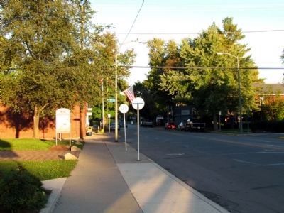
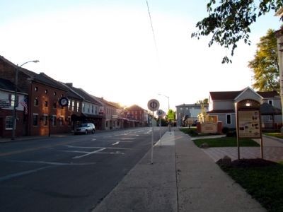
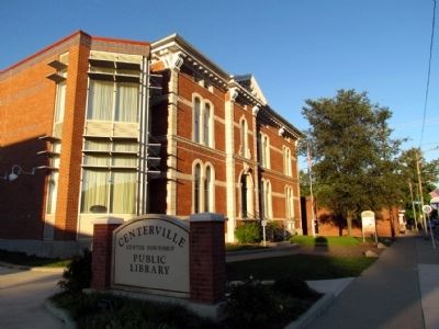
Location. 39° 49.07′ N, 84° 59.693′ W. Marker is in Centerville, Indiana, in Wayne County. Marker is at the intersection of E. Main Street (U.S. 40) and N. First Street, on the right when traveling west on E. Main Street. Marker is located in front of the Centerville–Center Township Public Library. Touch for map.
Marker is at or near this postal address: 126 E Main Street, Centerville IN 47330, United States of America. Touch for directions.
Other nearby markers. At least 8 other markers are within walking distance of this marker. Old Salisbury Court House (within shouting distance of this marker); Mansion House (within shouting distance of this marker); John Scott, 1793 (?)-1838 (within shouting distance of this marker); Honor Roll (about 500 feet away, measured in a direct line); George Washington Julian (approx. 0.2 miles away); The Stencil House 1820 (approx. 0.2 miles away); Wayne County Seminary (approx. 0.2 miles away); Early Masonic Hall (approx. 0.2 miles away). Touch for a list and map of all markers in Centerville.
Also see . . . Indiana National Road Association. The official website of the Indiana National Road Association. Includes stories of the National Road in Indiana and a page on their interpretive panels about the National Road in the state. (Submitted on October 14, 2013.)
Credits. This page was last revised on September 22, 2023. It was originally submitted on October 14, 2013, by Duane Hall of Abilene, Texas. This page has been viewed 720 times since then and 21 times this year. Photos: 1, 2, 3, 4, 5, 6, 7. submitted on October 14, 2013, by Duane Hall of Abilene, Texas.
