Countryside in Kansas City in Jackson County, Missouri — The American Midwest (Upper Plains)
James G. Ashley, Jr. and Pamela C. Ashley
Inscription.
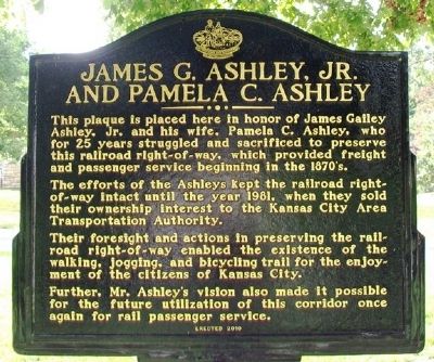
This plaque is placed here in honor of James Gailey Ashley, Jr. and his wife, Pamela C. Ashley, who for 25 years struggled and sacrificed to preserve this railroad right-of-way, which provided freight and passenger service beginning in the 1870's.
The efforts of the Ashleys kept the railroad right-of-way intact until the year 1981, when they sold their ownership interest to the Kansas City Area Transportation Authority.
Their foresight and actions in preserving the railroad right-of-way enabled the existence of the walking, jogging, and bicycling trail for the enjoyment of the citizens of Kansas City.
Further, Mr. Ashley's vision also made it possible for the future utilization of this corridor once again for rail passenger service.
Erected 2010 by Native Sons and Daughters of Greater Kansas City.
Topics and series. This historical marker is listed in these topic lists: Railroads & Streetcars • Roads & Vehicles. In addition, it is included in the Kansas City - Native Sons and Daughters of Greater Kansas City series list. A significant historical year for this entry is 1981.
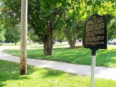
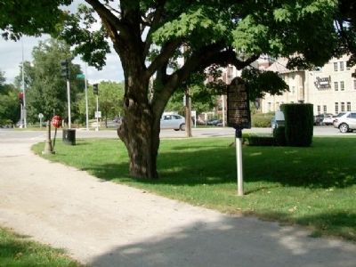
Location. 39° 1.638′ N, 94° 35.077′ W. Marker is in Kansas City, Missouri, in Jackson County. It is in Countryside. Marker is at the intersection of Brookside Boulevard and 55th Street, on the right when traveling north on Brookside Boulevard. Touch for map. Marker is in this post office area: Kansas City MO 64113, United States of America. Touch for directions.
Other nearby markers. At least 8 other markers are within walking distance of this marker. Country Club Line Historical Trolley Station (about 700 feet away, measured in a direct line); McGhee's Charge (approx. half a mile away); Battle of Westport (approx. half a mile away); The French and the Osage (approx. half a mile away); a different marker also named Battle of Westport (approx. half a mile away); Union Artillery (approx. 0.7 miles away); First Home of the Kansas City Country Club (approx. 0.7 miles away); Centennial Anniversary of Japan's Gift of Cherry Trees (approx. 0.7 miles away). Touch for a list and map of all markers in Kansas City.
Also see . . . Harry Wiggins Trolley Track Trail. Trail Link website entry (Submitted on October 15, 2013, by William Fischer, Jr. of Scranton, Pennsylvania.)
Credits. This page was last revised on February 10, 2023. It was originally submitted on October 15, 2013, by William Fischer, Jr. of Scranton, Pennsylvania. This page has been viewed 794 times since then and 23 times this year. Photos: 1, 2, 3. submitted on October 15, 2013, by William Fischer, Jr. of Scranton, Pennsylvania.


