Kensington in Kansas City in Wyandotte County, Kansas — The American Midwest (Upper Plains)
Riverview Boulevard Cable Car Line
Inscription.
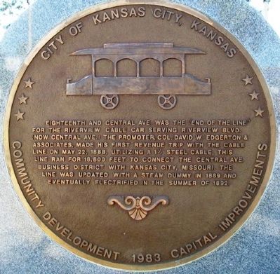
Eighteenth and Central Ave. was the "end of the line" for the Riverview Cable Car serving Riverview Blvd. (now Central Ave.) The promoter, Col. David W. Edgerton & Associates, made his first revenue trip with the cable line on May 22, 1888. Utilizing a 1˝ steel cable, this line ran for 18,800 feet to connect the Central Ave. business district with Kansas City, Missouri. The line was updated with a steam dummy in 1889 and eventually electrified in the summer of 1892.
Erected 1983 by City of Kansas City, Kansas, Community Development & Capital Improvements.
Topics. This historical marker is listed in these topic lists: Industry & Commerce • Railroads & Streetcars. A significant historical date for this entry is May 22, 1888.
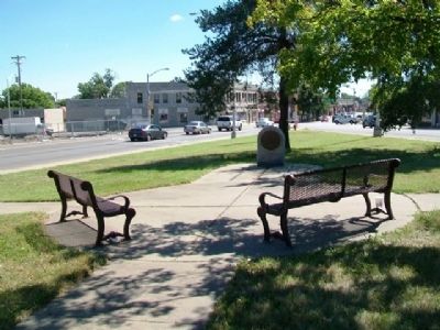
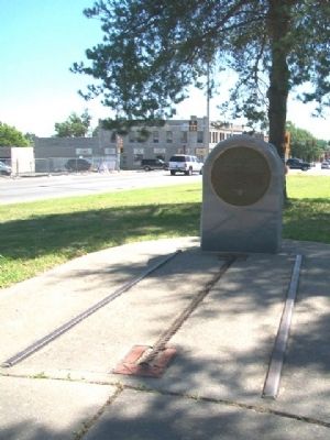
Location. 39° 6.365′ N, 94° 39.015′ W. Marker is in Kansas City, Kansas, in Wyandotte County. It is in Kensington. Marker is at the intersection of Central Avenue and 19th Street, on the right when traveling east on Central Avenue. Touch for map. Marker is in this post office area: Kansas City KS 66102, United States of America. Touch for directions.
Other nearby markers. At least 8 other markers are within 2 miles of this marker, measured as the crow flies. Soldiers and Sailors Memorial (approx. 1.3 miles away); Judge Cordell D. Meeks, Sr. Plaza (approx. 1.3 miles away); The History of the Wyandot Indian Nation (approx. 1.4 miles away); Silas Armstrong (approx. 1.4 miles away); Eliza Burton Conley (approx. 1˝ miles away); Helena Conley (approx. 1˝ miles away); Veterans Memorial (approx. 1˝ miles away); St. Mary's Church (approx. 1.6 miles away). Touch for a list and map of all markers in Kansas City.
Also see . . . "Street Railway Facilities" in History of Wyandotte County Kansas (1911). KSGenWeb website entry (Submitted on October 16, 2013, by William Fischer, Jr. of Scranton, Pennsylvania.)
Credits. This page was last revised on February 10, 2023. It was originally submitted on October 16, 2013, by William Fischer, Jr. of Scranton, Pennsylvania. This page has been viewed 416 times since then and 8 times this year. Photos: 1, 2, 3. submitted on October 16, 2013, by William Fischer, Jr. of Scranton, Pennsylvania.


