Downtown Las Vegas in Clark County, Nevada — The American Mountains (Southwest)
The Morelli House
Photographed by Bill Kirchner, October 3, 2013
1. The Morelli House Marker
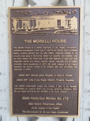
The Morelli House is a classic example of Las Vegas, mid-century residential architecture. It was built in 1959 by the Sands Hotel orchestra leader, Antonio Morelli, and his wife Helen. Originally located at 52 Country Club Lane in the former Desert Inn Country Club Estates, now the Wynn Resort, the modernistic house then featured an open plan that integrated interior, and exterior spaces, natural materials, and the latest innovative home appliances. In 2001, the Junior League of Las Vegas relocated the Morelli House to its present site and completed the restoration in 2009.
Listed 2001, Nevada State Register of Historic Places.
Listed 2007, City of Las Vegas Historic Property Register
This historic preservation project was funded, in part, by the Nevada Commission for Cultural Affairs and through generous donations from the Las Vegas community and members of the Junior League.
Erected by State Historic Preservation Office, Junior League of Las Vegas, The Commission for the Las Vegas Centennial. (Marker Number 270.)
Topics. This historical marker is listed in this topic list: Architecture. A significant historical year for this entry is 1959.
Location. 36° 9.921′ N,
this page online

Regionally, this marker is in the Mojave Desert. It is also in the American Southwest and in the Mountain West. Globally, it is in North America, the Western Hemisphere, the Western World, and the Anglosphere. Historically, it finds itself in what was once New Spain and also Mexico’s Alta California.
Other nearby markers. At least 8 other markers are within walking distance of this marker: History of the "Senior Squares" (about 600 feet away, measured in a direct line); Las Vegas High School (about 700 feet away); Las Vegas High School / Las Vegas High School Neighborhood (about 700 feet away); Original Homesite of a Las Vegas Pioneer: Charles 'Pop’ Squires (approx. 0.2 miles away); Birth of Downtown Las Vegas (approx. 0.3 miles away); Aladdin's Lamp (approx. 0.3 miles away); Ralph Louis Engelstad
Photographed by Bill Kirchner, October 3, 2013
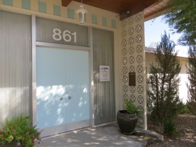
2. The Morelli House Marker
Another marker is no longer nearby. Historic 5th Street School (was approx. 0.3 miles away but has been confirmed missing).
Also see . . . New Amended Text for Marker. The Nevada State Historic Preservation Office (SHPO) recently updated the text of the roughly 260 state historical markers in Nevada. The Nevada SHPO placed the amended text of each individual marker on its website and will change the actual markers in the field as funding allows. Minor changes have been made to this marker for grammar and readability. The link will take you to the Nevada SHPO page for the marker with the amended text. (Submitted on October 25, 2013, by Duane Hall of Abilene, Texas.)
Photographed by Bill Kirchner, October 3, 2013
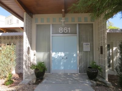
3. The Morelli House Marker
Photographed by Bill Kirchner, October 3, 2013
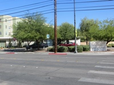
4. The Morelli House
Photographed by Bill Kirchner, October 3, 2013
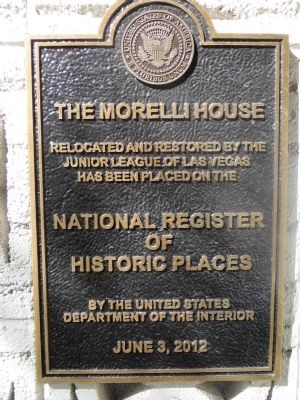
5. NRHP Plaque
The Morelli House
Relocated and restored by the Junior League of Las Vegas has been placed on the National Register of Historic Places By the United States Department of the Interior
June 3, 2012
Relocated and restored by the Junior League of Las Vegas has been placed on the National Register of Historic Places By the United States Department of the Interior
June 3, 2012
Credits. This page was last revised on April 1, 2023. It was originally submitted on October 17, 2013, by Bill Kirchner of Tucson, Arizona. This page has been viewed 1,397 times since then and 68 times this year. Photos: 1, 2, 3, 4, 5. submitted on October 17, 2013, by Bill Kirchner of Tucson, Arizona. • Syd Whittle was the editor who published this page.
