Franklin, Virginia — The American South (Mid-Atlantic)
Camp Family Homestead
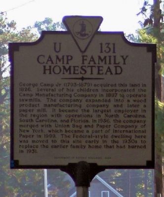
Photographed by Mike Stroud, October 5, 2013
1. Camp Family Homestead Marker
Erected 2004 by Department of Historic Resources. (Marker Number U-131.)
Topics and series. This historical marker is listed in this topic list: Industry & Commerce. In addition, it is included in the Virginia Department of Historic Resources (DHR) series list. A significant historical year for this entry is 1826.
Location. 36° 41.107′ N, 76° 56.132′ W. Marker is in Franklin, Virginia. It is on Homestead Road near Wynnwood Drive, on the right when traveling north. Touch for map. Marker is at or
this page online

Regionally, this marker is in Coastal Virginia. It is also in the American South, specifically in the Upper South, and in the Tidewater. Globally, it is in North America, the Western Hemisphere, the Western World, and the Anglosphere. Historically, it finds itself in what was once the territory of the Mississippian Culture, one of the original Thirteen Colonies, one of the Confederate States of America, and the Antebellum South.
Other nearby markers. At least 8 other markers are within 2 miles of this marker, measured as the crow flies: Franklin Memorial Park (approx. ¼ mile away); Confederate Monument (approx. 0.3 miles away); Pauline Cauthorne Morton (1912-2004) (approx. ¾ mile away); Lyons State Theatre (approx. one mile away); Blackwater Line - Franklin (approx. one mile away); Camp Manufacturing Company (approx. 1.1 miles away); The Flood of September 1999 (approx. 1.1 miles away); Franklin (approx. 1.1 miles away). Touch for a list and map of all markers in Franklin.
Also see . . . Franklin, Virginia - Industrialization and the Camp family.
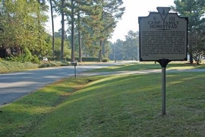
Photographed by Mike Stroud, October 5, 2013
2. Camp Family Homestead Marker seen on Homestead Road
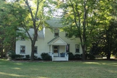
Photographed by Mike Stroud, October 5, 2013
3. Camp Family Homestead seen today
Credits. This page was last revised on July 7, 2021. It was originally submitted on October 18, 2013, by Mike Stroud of Bluffton, South Carolina. This page has been viewed 2,964 times since then and 118 times this year. Photos: 1. submitted on October 19, 2013, by Mike Stroud of Bluffton, South Carolina. 2. submitted on October 18, 2013, by Mike Stroud of Bluffton, South Carolina. 3. submitted on October 19, 2013, by Mike Stroud of Bluffton, South Carolina.
