
Union in Union County, New Jersey — The American Northeast (Mid-Atlantic)
Colonel Elias Dayton
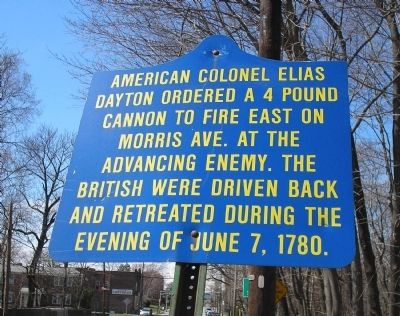
Photographed by Bill Coughlin, April 5, 2008
1. British Invasion Marker
This is one of a series of markers in Union, NJ telling the story of the British Invasion of 1780.
Topics. This historical marker is listed in this topic list: War, US Revolutionary. A significant historical date for this entry is June 7, 1962.
Location. 40° 42.465′ N, 74° 18.087′ W. Marker is in Union, New Jersey, in Union County. It is on Morris Avenue (County Route 82), on the right when traveling west. Marker is just east of the bridge over the Rahway River on the Union - Springfield border. Touch for map. Marker is in this post office area: Union NJ 07083, United States of America. Touch for directions.

Regionally, this marker is in New Jersey’s North Jersey, in Greater Newark, and in the New York City Metropolitan Area. It is also in the American Northeast, in the Mid-Atlantic, and on the Eastern Seaboard. Globally, it is in the North Atlantic Region, North America, the Western Hemisphere, the Western World, and the Anglosphere. Historically, it finds itself in what was once New Netherland and also one of the original Thirteen
this page online
Other nearby markers. At least 8 other markers are within walking distance of this marker: To the memory of Colonel Israel Angell (within shouting distance of this marker); The Jersey Militia and Continental Army (within shouting distance of this marker); The Cannonball House (approx. 0.3 miles away); Battle of Springfield (approx. 0.3 miles away); Colonial Church (approx. half a mile away); Springfield (approx. half a mile away); a different marker also named The Battle of Springfield (approx. half a mile away); Patriots who fell at Springfield (approx. 0.6 miles away).
Also see . . . The Battles of Connecticut Farms and Springfield. (Submitted on April 7, 2008, by Bill Coughlin of Woodland Park, New Jersey.)
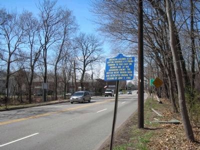
Photographed by Bill Coughlin, April 5, 2008
2. Marker at the Rahway River Bridge
The Americans met the British / Hessian army at this bridge prior to the Battle of Springfield. After finally being defeated on June 23, 1780, the British retreated back across this bridge. The photo looks towards Springfield.
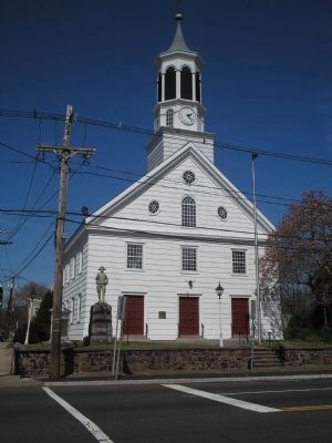
Photographed by Bill Coughlin, April 5, 2008
3. Springfield Presbyterian Church
The Battle of Springfield took place around this church on June 23, 1780. The British were defeated, but they burned most of the town, including the church, before retreating.
Credits. This page was last revised on November 18, 2021. It was originally submitted on April 7, 2008, by Bill Coughlin of Woodland Park, New Jersey. This page has been viewed 1,597 times since then and 26 times this year. Photos: 1, 2, 3. submitted on April 7, 2008, by Bill Coughlin of Woodland Park, New Jersey. • Craig Swain was the editor who published this page.
