Groveton near Alexandria in Fairfax County, Virginia — The American South (Mid-Atlantic)
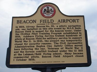
Beacon Field Airport
Erected 2009 by Fairfax County History Commission.
Topics and series. This historical marker is listed in these topic lists: Air & Space • Notable Places • War, World II. In addition, it is included in the Virginia, Fairfax County History Commission series list. A significant historical date for this entry is October 1, 1959.
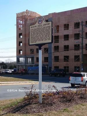
Location. 38° 46.2′ N, 77° 4.967′ W. Marker is near Alexandria, Virginia, in Fairfax County. It is in Groveton. Marker can be reached from the intersection of Richmond Highway (U.S. 1) and Memorial Street, on the right when traveling south. The marker is located on the Beacon Center property at the south entrance from Memorial Street. This is the Beacon Hill area of Fairfax County. Other nearby marker US Route 1 Wall of Aviation located approximately 2 miles south on US 1 roadside of Costco complex. Touch for map. Marker is at or near this postal address: 6700 Richmond Highway, Alexandria VA 22306, United States of America. Touch for directions.
Other nearby markers. At least 8 other markers are within walking distance of this marker. Huntley (approx. 0.7 miles away); Unfolding Views, Hidden Stories (approx. 0.7 miles away); New Views, New Voices (approx. 0.7 miles away); Your View, Your Voice (approx. 0.7 miles away); a different marker also named Huntley (approx. ĺ mile away); A View from the Beginning / Explore Historic Huntley (approx. ĺ mile away); Missing Views, Lost Stories (approx. ĺ mile away); Defenses of Washington (approx. 0.8 miles away). Touch for a list and map of all markers in Alexandria.
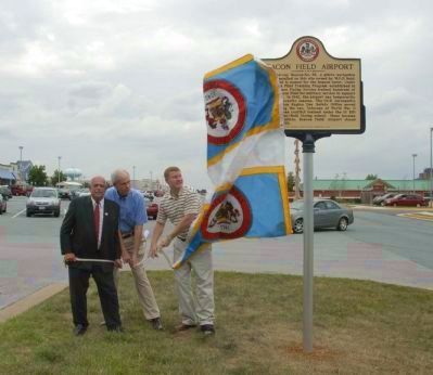
More about this marker. Marker was installed on August 18, 2009, and the dedication ceremony held August 19, 2009.
Also see . . .
1. The History of Beacon Field. Notable celebrities, historic aviation and area photos, and detailed history of City View, the Reid and Barton families can be found on the website. “Initially the airfield was named Groveton Flying Field and was used for recreational flying and U.S. Air Mail pilots. The exact date of airport establishment is not known as W.F.P. Reid owned the pasture land on which a light tower, a beacon for US Air Mail pilots, was installed by the US Government in the late 1920s. The beacon was designated Airway Beacon No. 55 on Mt. Vernon Highway. At elevation of 249 feet, the area commanded one of the highest points in Fairfax County.” (Submitted on August 22, 2009.)
2. Beacon Field Airport. Main home page for Beacon Field Airport (Submitted on August 28, 2009.)
Credits. This page was last revised on January 27, 2023. It was originally submitted on August 22, 2009, by Friends of Beacon Field Airport of Fairfax County, Virginia. This page has been viewed 2,966 times since then and 149 times this year. Last updated on October 20, 2013, by Friends of Beacon Field Airport of Fairfax County, Virginia. Photos: 1. submitted on August 22, 2009, by Friends of Beacon Field Airport of Fairfax County, Virginia. 2. submitted on February 9, 2014, by Friends of Beacon Field Airport of Fairfax County, Virginia. 3. submitted on August 22, 2009, by Friends of Beacon Field Airport of Fairfax County, Virginia. • Bernard Fisher was the editor who published this page.


