Clinton in Henry County, Missouri — The American Midwest (Upper Plains)
Poague Building Explosion Victims
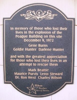
Photographed by William Fischer, Jr., October 11, 2013
1. Poague Building Explosion Victims Marker
Gene Burns • Goldie Hunter • Darlene Hunter
and with the greatest appreciation for those who lost their lives in an attempt to rescue them
Mark Beattie • Maurice Purvis • Leroy Steward
Dr. Ron West • Charles Wilson
Erected by Hilton Random Acts of Service.
Topics. This historical marker is listed in these topic lists: Disasters • Industry & Commerce. A significant historical date for this entry is December 9, 1972.
Location. 38° 22.148′ N, 93° 46.56′ W. Marker is in Clinton, Missouri, in Henry County. It is at the intersection of Main Street and Jefferson Street, on the left when traveling south on Main Street. Touch for map. Marker is at or near this postal address: 200 South Main Street, Clinton MO 64735, United States of America. Touch for directions.

Regionally, this marker is in the American Midwest, in the Lewis & Clark Corridor, and in the Corn Belt. Globally, it is in North America, the Western Hemisphere, the Western World, and the Anglosphere. Historically, it finds itself in what was once
this page online
Other nearby markers. At least 8 other markers are within 2 miles of this marker, measured as the crow flies: Founding of Clinton, as County Seat of Henry County (about 400 feet away, measured in a direct line); September 11, 2001 (about 500 feet away); Baby Chick Capital of the World (about 500 feet away); Brown Mfg. Co. (about 500 feet away); Henry County (about 600 feet away); The Anheuser-Busch Building (approx. 0.2 miles away); Clinton Area (approx. 1.4 miles away); Katy Trail State Park (approx. 1.4 miles away). Touch for a list and map of all markers in Clinton.
Also see . . . Missouri Public Service Company, Clinton, Missouri; December 9, 1972. National Academies of Sciences, Engineering, and Medicine website entry (Submitted on May 1, 2022, by Larry Gertner of New York, New York.)
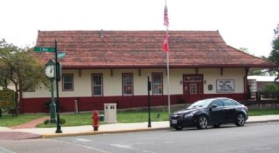
Photographed by William Fischer, Jr., October 11, 2013
2. Poague Building Explosion Victims Marker
Credits. This page was last revised on November 22, 2024. It was originally submitted on October 20, 2013, by William Fischer, Jr. of Reynoldsburg, Ohio. This page has been viewed 1,292 times since then and 76 times this year. Photos: 1, 2. submitted on October 20, 2013, by William Fischer, Jr. of Reynoldsburg, Ohio.
