Fillmore in Millard County, Utah — The American Mountains (Southwest)
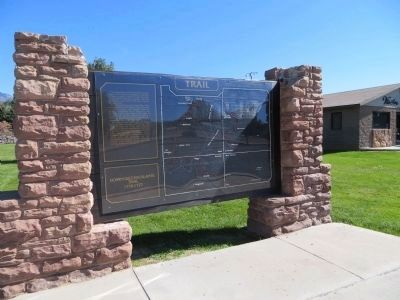
Dominguez - Escalante Trail
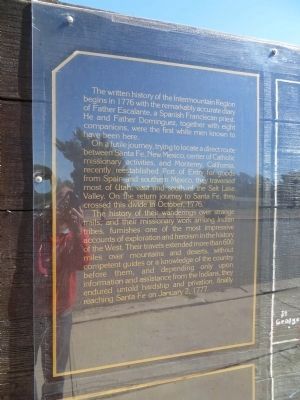
On a futile journey, trying to locate a direct route between Santa Fe, New Mexico, center of Catholic Missionary activities, and Monterey, California, recently reestablished Port of Entry for goods from Spain and southern Mexico, they traversed most of Utah, east and south of the Salt Lake Valley. On the return trip to Santa Fe, they crossed this divide in October, 1776.
The history of their wanderings over strange trails, and their missionary work among Indian tribes, furnishes one of the most impressive accounts of exploration and heroism in the history of the West. Their travels extended more than 600 miles over mountains and deserts, without competent guides or a knowledge of the country before them, and depending only upon information and assistance from the Indians, they endured untold hardship and privation, finally reaching Santa Fe on January 2, 1777.
Dominguez Escalante Trail 1776 – 1777
Topics and series. This historical marker is listed in these topic lists: Exploration • Settlements & Settlers . In addition, it is included in the Dominguez y Escalante Expedition series list. A significant historical month for this entry is January 1883.
Location. 38° 58.763′ N, 112° 19.398′ W. Marker is in Fillmore, Utah, in Millard County. Marker is on North Main Street, on the right when traveling north. Marker is in parking lot for Fillmore City Park. Touch for map. Marker is at or near this postal address: 500 North Main Street, Fillmore UT 84631, United States of America. Touch for directions.
Other nearby markers. At least 8 other markers are within 8 miles of this marker, measured as the crow flies. Capitol (within shouting distance of this marker); Fillmore's Adobe Church (about 400 feet away, measured in a direct line); Fillmore Pioneer Fort (approx. ¾ mile away); Edward Partridge, Jr. House (approx. 0.8 miles away); Utah’s First Capitol (approx. 0.8 miles away); Land of the Yuta (approx. 0.8 miles away); Little Rock Schoolhouse (approx. 0.9 miles away); Chief Walkara (approx. 7.7 miles away). Touch for a list and map of all markers in Fillmore.
Credits. This page was last revised on June 16, 2016. It was originally submitted on October 21, 2013, by Bill Kirchner of Tucson, Arizona. This page has been viewed 606 times since then and 19 times this year. Photos: 1, 2. submitted on October 21, 2013, by Bill Kirchner of Tucson, Arizona. • Syd Whittle was the editor who published this page.

