Oceana Naval Air Station in Virginia Beach, Virginia — The American South (Mid-Atlantic)
Eastern Shore Chapel
Photographed by Mike Stroud, October 5, 2013
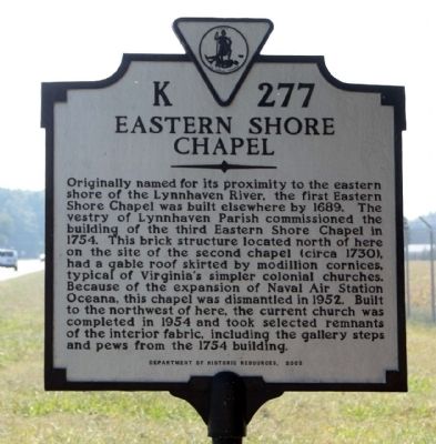
1. Eastern Shore Chapel Marker
Originally named for its proximity to the eastern shore of the Lynnhaven River, the first Eastern Shore Chapel was built elsewhere by 1689. The vestry of Lynnhaven Prish commissioned the building of the third Eastern Shore Chapel in 1754. This brick structure located north of here on the site of the second chapel (circa 1730), had a gable roof skirted by modillion cornices, typical of Virginia's simpler colonial churches. Because of the expansion of the Naval Air Station Oceana, this chapel was dismantled in 1952. Built to the northwest of here, the current church was completed in 1954 and took selected remnants of the interior fabric, including the gallery steps and pews from the 1754 building.
Erected 2002 by Department of Resources. (Marker Number K--277.)
Topics and series. This historical marker is listed in this topic list: Religion & Religious Structures. In addition, it is included in the Virginia Department of Historic Resources (DHR) series list. A significant historical year for this entry is 1689.
Location. 36° 49.005′ N, 76° 0.428′ W. Marker is in Virginia Beach, Virginia. It is in Oceana
this page online

Regionally, this marker is in Hampton Roads, specifically in Coastal Virginia, and in the Hampton Roads Metropolitan Area. It is also in the American South, specifically in the Upper South, in the Tidewater, and on the Eastern Seaboard. Globally, it is in the North Atlantic Region, North America, the Western Hemisphere, the Western World, and the Anglosphere. Historically, it finds itself in what was once the territory of the Mississippian Culture, one of the original Thirteen Colonies, one of the Confederate States of America, and the Antebellum South.
Other nearby markers. At least 8 other markers are within 2 miles of this marker, measured as the crow flies: The Flame of Hope (within shouting distance of this marker); Flame Of Hope (within shouting distance of this marker); Tree of Hope (about 300 feet away, measured in a direct line); State Military Reservation (approx.
Photographed by Mike Stroud, October 5, 2013
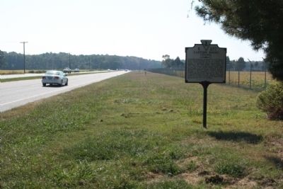
2. Eastern Shore Chapel Marker along southbound Oceana Boulevard
Photographed by Mike Stroud, October 5, 2013
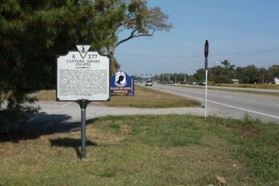
3. Eastern Shore Chapel Marker looking north along Oceana Boulevard
Credits. This page was last revised on February 1, 2023. It was originally submitted on October 22, 2013, by Mike Stroud of Bluffton, South Carolina. This page has been viewed 1,088 times since then and 65 times this year. Photos: 1, 2, 3. submitted on October 22, 2013, by Mike Stroud of Bluffton, South Carolina.
