Near Eureka in Eureka County, Nevada — The American Mountains (Southwest)
Diamond Valley
Photographed by Bill Kirchner, October 6, 2013
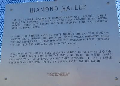
1. Diamond Valley Marker
Colonel J.H. Simpson mapped a route through the valley in 1859. The Simpson route, through the north end of the valley, immediately became the Pony Express route from 1860-1861. The Overland telegraph replaced the Pony Express and also crossed the valley.
Early freight toll roads were operated across the valley as lead and silver mining camps boomed in the 1860's. Needs of the mining camps gave rise to a limited livestock and dairy industry. In 1957, a large underground lake was tapped to supply water for irrigation.
Erected by Nevada State Park System, Eureka County Commission. (Marker Number 82.)
Topics and series. This historical marker is listed in these topic lists: Communications • Exploration. In addition, it is included in the Pony Express National Historic Trail series list. A significant historical year for this entry is 1845.
Location. 39° 45.333′ N, 116° 5.034′ W. Marker is near
this page online

Regionally, this marker is in the Northern Nevada and in Elko Country. It is also in the American Mountain West. Globally, it is in North America, the Western Hemisphere, the Western World, and the Anglosphere. Historically, it finds itself in what was once New Spain and also Mexico’s Alta California.
Other nearby markers. At least one other marker is within 15 miles of this marker, measured as the crow flies: The Eureka Mining District (approx. 14.6 miles away).
Also see . . . New Amended Text for Marker. The Nevada State Historic Preservation Office (SHPO) recently updated the text of the roughly 260 state historical markers in Nevada. The Nevada SHPO placed the amended text of each individual marker on its website and will change the actual markers in the field as funding allows. Minor changes have been made to the marker for grammar and readability. The link will take you to the
Photographed by Bill Kirchner, October 6, 2013
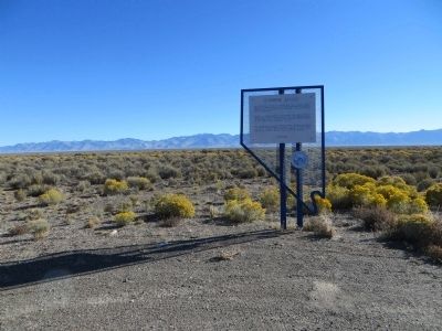
2. Diamond Valley Marker
Photographed by Bill Kirchner, October 6, 2013
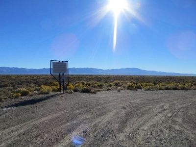
3. Diamond Valley Marker
Credits. This page was last revised on June 16, 2016. It was originally submitted on October 22, 2013, by Bill Kirchner of Tucson, Arizona. This page has been viewed 853 times since then and 32 times this year. Photos: 1, 2, 3. submitted on October 22, 2013, by Bill Kirchner of Tucson, Arizona. • Syd Whittle was the editor who published this page.
