Sonora in Tuolumne County, California — The American West (Pacific Coastal)
Rother's Corner
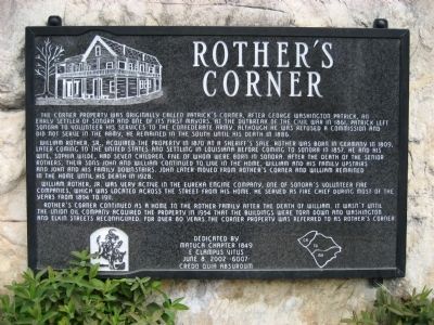
William Rother, Sr., acquired the property in 1870 at a sheriff’s sale. Rother was born in Germany in 1809, later coming to the United States and settling in Louisiana before coming to Sonora in 1857. He and his wife, Sophia Wilde, had seven children, five of whom were born in Sonora. After the death of the senior Rothers, their sons John and William continued to live in the home, William and his family upstairs and John and his family downstairs. John later moved from Rother’s Corner and William remained in the home until his death in 1928.
William Rother, Jr. was very active in the Eureka Engine Company, one of Sonora’s volunteer fire companies, which was located across the street from his home. He served as fire chief during most of the years from 1894 to 1911.
Rother’s Corner continued as a home to the Rother Family after the death of William. It wasn’t until the Union Oil Company acquired the property in 1954 that the buildings were torn down and Washington and Elkin Streets reconfigured. For over 80 years the corner property was referred to as Rother’s Corner.
Erected 2002 by Matuca Chapter No. 1849, E Clampus Vitus. (Marker Number 6007.)
Topics and series. This historical marker is listed in these topic lists: Charity & Public Work • Industry & Commerce • Law Enforcement • Settlements & Settlers. In addition, it is included in the E Clampus Vitus series list. A significant historical year for this entry is 1861.
Location. 37° 59.223′ N, 120° 23.052′ W. Marker is in Sonora, California, in Tuolumne County. Marker is at the intersection of North Washington St. (State Highway 49) and Elkins Street, on the right when traveling north on North Washington St.. Touch for map. Marker is in this post office area: Sonora CA 95370, United States of America. Touch for directions.
Other nearby markers. At least 8 other markers are within walking distance of this marker. Sonora IOOF Lodge No. 10 (about 400 feet away, measured in a direct line); -Yo- Semite House (about 400 feet away); Original Site of the Sonora Daily (about 500 feet away); Site of the First Office of The Union Democrat (about 600 feet away); Tuolumne County Albert N. Francisco Building (about 600 feet away); Tuolumne County Courthouse (about 600

Photographed By Richard Wisehart, April 8, 2008
2. Rother's Corner
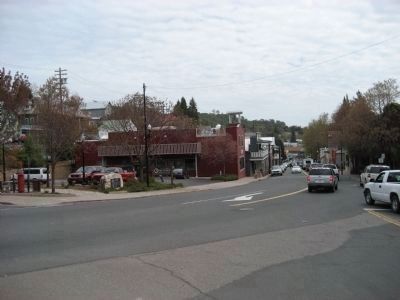
View is southerly. North Washington St., leading into downtown Sonora, is on the right. Elkins St. is just off the left edge of photo. Marker is in left middleground. Red, balconied building behind the marker is a fire museum. In the 1980's and 1990's the building was a 7-11 store.
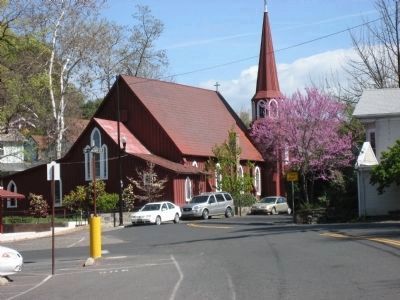
Additional keywords. St. James Episcopal Church, California Historical Landmark No. 139
Credits. This page was last revised on January 23, 2024. It was originally submitted on April 8, 2008, by Richard Wisehart of Sonora, California. This page has been viewed 2,111 times since then and 28 times this year. Photos: 1, 2. submitted on April 8, 2008, by Richard Wisehart of Sonora, California. 3. submitted on April 10, 2008, by Richard Wisehart of Sonora, California. • Kevin W. was the editor who published this page.

