Blountville in Sullivan County, Tennessee — The American South (East South Central)
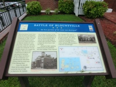
Battle of Blountville
"Öthe best portion of the town was destroyed"
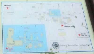
Union Col. John W. Foster led his cavalry brigade across the river at 9 A.M. on September 22. Confederate Col. James E. Carterís 1st Tennessee Cavalry defended Blountville. For four hours in the afternoon, as Foster occupied Cemetery Hill to your left, the two sides fought an artillery duel until Foster ordered a charge that drove Carterís men out of town.
During the fight, exploding shells set fire to the courthouse and other buildings. Foster reported that “the shells of the enemy set fire to the town, and a great portion of it was consumed.” Mrs. Walter E. Allen, however, later wrote that “a shell from the Federal guns entered the courthouse, setting it on fire, and soon all the best portion of the town was destroyed.”
(captions)
Sullivan County Courthouse, constructed 1854, ca. 1900 photo Courtesy Hunt Library
Sullivan County commissioners, ca. 1900 Courtesy Hunt Library
Erected by Tennessee Civil War Trails.
Topics and series. This historical marker is listed in these topic lists: Railroads & Streetcars • War, US Civil. In addition, it is included in the Tennessee Civil War Trails series list. A significant historical date for this entry is September 22, 1863.
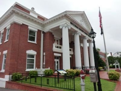
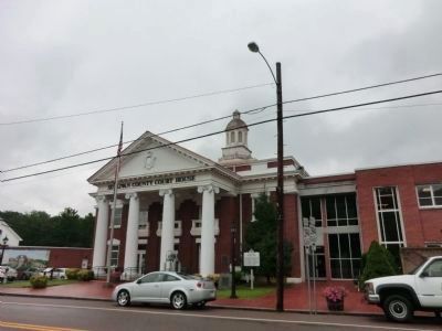
Location. 36° 31.98′ N, 82° 19.61′ W. Marker is in Blountville, Tennessee, in Sullivan County. Marker is on Bristol Highway (Tennessee Route 126) west of Anderson Road, on the right when traveling west. The marker is on the grounds of the Sullivan County Courthouse. Touch for map. Marker is at or near this postal address: 3425 Tennessee 126, Blountville TN 37617, United States of America. Touch for directions.
Other nearby markers. At least 8 other markers are within walking distance of this marker. James Brigham (here, next to this marker); Historic Courthouse Bell (a few steps from this marker); Battle of Blountville Confederate Memorial (a few steps from this marker); Sullivan County (a few steps from this marker); a different marker also named Battle of Blountville (a few steps from this marker); Sullivan County Veterans Memorial (within shouting distance of this marker); Old Deery Inn (within shouting distance of this marker); Brick Kitchen (within shouting distance of this marker). Touch for a list and map of all markers in Blountville.
Credits. This page was last revised on June 16, 2016. It was originally submitted on October 25, 2013, by Don Morfe of Baltimore, Maryland. This page has been viewed 793 times since then and 24 times this year. Photos: 1, 2, 3, 4. submitted on October 25, 2013, by Don Morfe of Baltimore, Maryland. • Bernard Fisher was the editor who published this page.


