Blountville in Sullivan County, Tennessee — The American South (East South Central)
Old Deery Inn
Refuge from the Storm
Photographed by Don Morfe, July 31, 2013
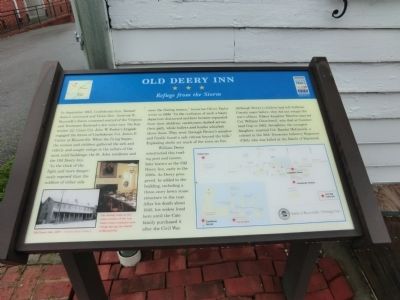
1. Old Deery Inn Marker
William Deery constructed this trading post and tavern, later known as the Old Derry Inn, early in the 1800s. As Deery prospered, he added to the building,
this page online
Although Deery’s children had left Sullivan County years before, they did not escape the war’s effects. Eldest daughter Martha married Col. William Churchwell, who died at Cumberland Gap in 1862. Seraphina, the youngest daughter, married Col. Randal McGavock, a colonel in the 10th Tennessee Infantry Regiment (CSA) who was killed at the Battle of Raymond.
(captions)
Old Deery Inn, 1927 — Courtesy Hunt Library
The dining room in the stone section of the inn where town residents took refuge during the Battle of Blountville
Erected by Tennessee Civil War Trails.
Topics and series. This historical marker is listed in these topic lists: Railroads & Streetcars • War, US Civil. In addition, it is included in the Tennessee Civil War Trails series list. A significant historical month for this entry is September 1863.
Location. 36° 31.987′ N, 82° 19.57′ W. Marker is in Blountville, Tennessee, in Sullivan County. It is on Bristol Highway (Tennessee Route 126) west of Anderson
Photographed by Don Morfe, July 31, 2013
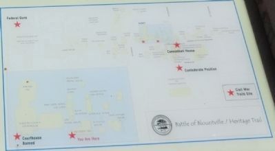
2. Battle of Blountville / Heritage Trail map

Regionally, this marker is in East Tennessee and in the Tri-Cities Area. It is also in the American South, specifically in the Upper South, in Appalachia, and specifically in Southern Appalachia. Globally, it is in North America, the Western Hemisphere, the Western World, and the Anglosphere. Historically, it finds itself in what was once the original Cherokee Nation, the territory of the Mississippian Culture, one of the Confederate States of America, the State of Franklin, and the Antebellum South.
Other nearby markers. At least 8 other markers are within walking distance of this marker: A different marker also named Old Deery Inn (a few steps from this marker); Brick Kitchen (within shouting distance of this marker); 1840 Smokehouse (within shouting distance of this marker); Anderson Townhouse (within shouting distance of this marker); Sullivan County Veterans Memorial (within shouting distance of this marker); King Ironworks Cabin
Photographed by Don Morfe, July 31, 2013
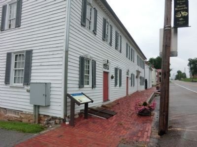
3. Old Deery Inn Marker
Photographed by Don Morfe, July 31, 2013
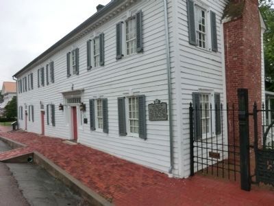
4. Old Deery Inn
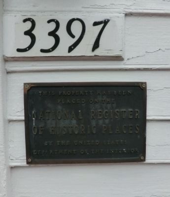
Photographed by Don Morfe, July 31, 2013
5. National Register of Historic Places plaque
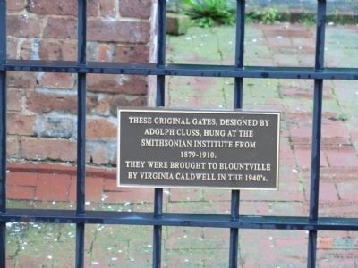
Photographed by Don Morfe, July 31, 2013
6. Old Deery Inn plaque
These original gates, designed by Adolph Cluss, hung at the Smithsonian Institute from 1879-1910. They were brought to Blountville by Virginia Caldwell in the 1940's.
Credits. This page was last revised on June 16, 2016. It was originally submitted on October 25, 2013, by Don Morfe of Baltimore, Maryland. This page has been viewed 1,260 times since then and 65 times this year. Photos: 1, 2, 3, 4, 5, 6. submitted on October 25, 2013, by Don Morfe of Baltimore, Maryland. • Bernard Fisher was the editor who published this page.
