Red Bank in Hamilton County, Tennessee — The American South (East South Central)
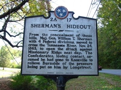
Sherman's Hideout
From the concealment of these hills, Maj. Gen. William T. Sherman with 4 Federal divisions, moved to cross the Tennessee River, Nov. 24, 1863, to open the attack against Missionary Ridge next day. The Confederates, losing contact, assumed he had gone to Knoxville to relieve Burnside of the pressure being put on him by Longstreet
Erected by Tennessee Historical Commission. (Marker Number 2A 17.)
Topics and series. This historical marker is listed in this topic list: War, US Civil. In addition, it is included in the Tennessee Historical Commission series list. A significant historical date for this entry is October 24, 1849.
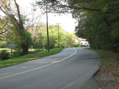
Location. 35° 5.473′ N, 85° 18.085′ W. Marker is in Red Bank, Tennessee, in Hamilton County. Marker is on Memorial Drive, 0.2 miles east of James Avenue, on the left when traveling east. Marker is located just east of the entrance to the Chattanooga Memorial Park Cemetery. Touch for map. Marker is at or near this postal address: 501 Memorial Drive, Chattanooga TN 37415, United States of America. Touch for directions.
Other nearby markers. At least 8 other markers are within 2 miles of this marker, measured as the crow flies. Reinforcing Chattanooga (approx. 0.2 miles away); Chattanooga High School (approx. 0.8 miles away); Union Army Hospital (approx. 1.1 miles away); Wilder's Artillery Position (approx. 1.6 miles away); Chattanooga Golf and Country Club (approx. 1.9 miles away); Civil War River Crossing (approx. 1.9 miles away); David Beck Memorial (approx. 2 miles away); Hill Overlooks & Industrial Past (approx. 2.1 miles away).
Related markers. Click here for a list of markers that are related to this marker. To better understand the relationship, study each marker in the order shown.
Credits. This page was last revised on June 16, 2016. It was originally submitted on October 26, 2013, by Lee Hattabaugh of Capshaw, Alabama. This page has been viewed 1,053 times since then and 73 times this year. Photos: 1. submitted on October 26, 2013, by Lee Hattabaugh of Capshaw, Alabama. 2, 3. submitted on October 27, 2013, by Lee Hattabaugh of Capshaw, Alabama. • Bernard Fisher was the editor who published this page.


