Downtown in Anchorage, Alaska — Northwest (North America)
Resolution Park 1776
⎯⎯⎯
1778
Photographed by Byron Hooks, September 1, 2013
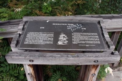
1. Resolution Park 1776 / 1778 Marker
On the fourth day of July, the Representatives of the United States of America, in general congress assembled at Philadelphia, declared their independence from Great Britain, setting out upon a course of constitutional government which carry a new concept of personal and political freedom from the east of North America to the western shores of the continent.
In the same July week, Captain James Cook, Royal Navy, took command of two ships in Plymouth Harbor, England. He sailed forth with orders to chart the vast reaches of the Pacific Ocean and to find a northwest passage from Europe to Asia around the top of the western hemisphere.
His voyages of discovery and scientific survey ranged from the Antarctic to Australasia; from South Seas and Hawaii to Arctic Alaska. Captain Cook opened the world to the Pacific to the modern ear of global navigation and commerce.
this page online
Having charted the waters and coast of the main channel, Captain Cook dispatched two boats to examine the arm leading toward the east, and calling it River Turnagain, convinced now that no passage to the Atlantic existed here.
Documents claiming possession of the land in the name of the king, together with some coins, were sealed in a bottle and buried at Point Possession, 20 miles south of this park on Kenai Peninsula. The majestic waterway, stretching from this point 150 miles to the open sea, was chosen by the admiralty to commemorate England’s greatest navigator, and thenceforth bears the name Cook Inlet.
1976
Erected 1976 by Anchorage Bicentennial Commission.
Topics and series. This historical marker is listed in this topic list: Exploration. In addition, it is included in the The Spirit of ’76, America’s Bicentennial Celebration series list. A significant historical month for this entry is July 1776.
Location. 61° 13.159′ N, 149° 54.238′ W. Marker is in Anchorage, Alaska. It is in Downtown. It is on
Photographed by Byron Hooks, September 1, 2013
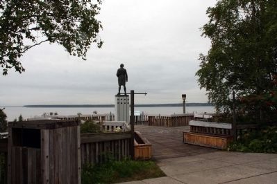
2. Resolution Park Entrance and statue of Captain Cook

Regionally, this marker is in the Alaska Railroad Corridor, in the Athabascan Region, in the Prince William Sound, and in Southcentral Alaska. It is also on the American Pacific Coast. Globally, it is in North America, on the Ring of Fire, on the Pacific Rim, in the Western Hemisphere, in the Western World, and in the Anglosphere. Historically, it finds itself in what was once the Russian Empire.
Other nearby markers. At least 8 other markers are within walking distance of this marker: Captain James Cook (here, next to this marker); Commemorating the Visit of Pope John Paul II (approx. ¼ mile away); Monument to William H. Seward (approx. 0.4 miles away); Historic Anchorage Hotel (approx. 0.4 miles away); The Freedom Tree (approx. 0.4 miles away); Martin Luther King, Jr. Living Memorial (approx. 0.4 miles away); Combat Wounded Veterans (approx. 0.4 miles away); The Bear and Raven (approx.
Photographed by Byron Hooks, September 1, 2013
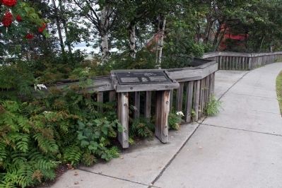
3. Resolution Park 1776 / 1778 Marker
More about this marker. Resolution Park features a statue of Captain Cook and a magnificent view of Cook Inlet.
Photographed by Byron Hooks, September 1, 2013
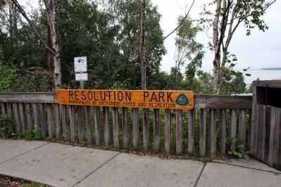
4. Resolution Park Entrance
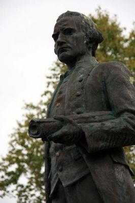
Photographed by Byron Hooks, September 1, 2013
5. Captain James Cook
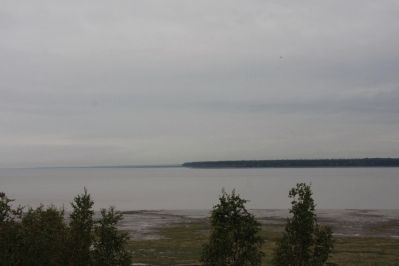
Photographed by Byron Hooks, September 1, 2013
6. Cook Islet
Credits. This page was last revised on June 16, 2016. It was originally submitted on September 13, 2013, by Byron Hooks of Sandy Springs, Georgia. This page has been viewed 1,126 times since then and 43 times this year. Last updated on October 27, 2013, by Byron Hooks of Sandy Springs, Georgia. Photos: 1, 2, 3, 4, 5, 6. submitted on September 13, 2013, by Byron Hooks of Sandy Springs, Georgia. • Syd Whittle was the editor who published this page.
