Anchorage, Alaska — Northwest (North America)
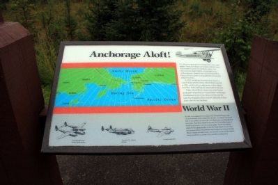
Anchorage Aloft!
In 1923, Anchorage boasted its first airport - where Delaney Park is today. Merrill Field was built in 1930, and in 1945 recorded more civilian flights then New York’s LaGuardia airport did in that year.
Today, Merrill Field remains one of the busiest small-plane airports in the United States. Anchorage’s International Airport host 30 air carriers, and the Lake Hood Seaplane Base ranks #1 nationally in float plane takeoffs and landings.
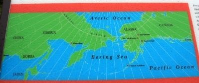
By 1940, it was apparent to the military that Alaska would play a vital role in the defense of the United States. By 1941, two military bases were built on the outskirts of Anchorage - Fort Richardson and Elmendorf Air Force Base. These bases supported the only WW II campaign fought on North American soil - the Aleutian Campaign. The Aleutian Islands stretch for thousands of miles out into the Pacific Ocean. In June, 1942, the Japanese bombed Dutch Harbor and occupied the Western Aleutian Islands. In spite of terrible storms, the two year air war over the isolated islands resulted in American victory over the invading forces.
Topics. This historical marker is listed in these topic lists: Air & Space • War, World II. A significant historical month for this entry is June 1942.
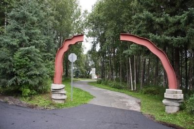
Location. 61° 11.858′ N, 149° 58.752′ W. Marker is in Anchorage, Alaska. Marker is on West Northern Lights Boulevard. This marker is located in Earthquake Park on W Northern Lights Blvd. It is also accessible from the Tony Knowles Bicycle Trail. Parking is available on W Northern Lights Blvd. (N 61° 11.756 W 149° 58.578). From the parking lot, follow the paved path to the marker. Touch for map. Marker is in this post office area: Anchorage AK 99502, United States of America. Touch for directions.
Other nearby markers. At least 8 other markers are within 5 miles of this marker, measured as the crow flies. Tsunami! (within shouting distance of this marker); Turnagain Heights Slide (about 400 feet away, measured in a direct line); Measuring the Magnitude of Damage (about 400 feet away); The Earth Did Quake (about 400 feet away); Oscar Gill House (approx. 2½ miles away); Resolution Park 1776 / 1778 (approx. 2.9 miles away); Captain James Cook (approx. 2.9 miles away); What is this “Rock Man”? (approx. 4.2 miles away). Touch for a list and map of all markers in Anchorage.
Also see . . . Ted Stevens Anchorage International Airport. Source: Wikipedia (Submitted on October 20, 2013, by Byron Hooks of Sandy Springs, Georgia.)
Credits. This page was last revised on October 6, 2019. It was originally submitted on October 20, 2013, by Byron Hooks of Sandy Springs, Georgia. This page has been viewed 744 times since then and 17 times this year. Last updated on October 28, 2013, by Byron Hooks of Sandy Springs, Georgia. Photos: 1, 2, 3. submitted on October 20, 2013, by Byron Hooks of Sandy Springs, Georgia. • Syd Whittle was the editor who published this page.


