Near Clear Spring in Washington County, Maryland — The American Northeast (Mid-Atlantic)
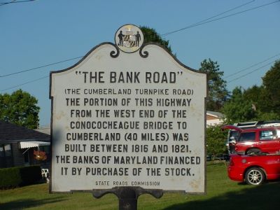
“The Bank Road”
(The Cumberland Turnpike Road)
Erected by State Roads Commission.
Topics and series. This historical marker is listed in this topic list: Roads & Vehicles. In addition, it is included in the The Historic National Road series list. A significant historical year for this entry is 1816.
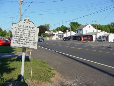
Location. 39° 39.449′ N, 77° 51.5′ W. Marker is near Clear Spring, Maryland, in Washington County. Marker is on National Pike (U.S. 40) 0.7 miles west of Wilson Bridge Park Lane, on the right when traveling west. Touch for map. Marker is in this post office area: Clear Spring MD 21722, United States of America. Touch for directions.
Other nearby markers. At least 5 other markers are within walking distance of this marker. Wilson’s Store (approx. 0.4 miles away); Gettysburg Campaign (approx. 0.4 miles away); a different marker also named Gettysburg Campaign (approx. half a mile away); Miller's Tavern & Spickler's Buggy Factory (approx. half a mile away); Wilson Bridge (approx. 0.6 miles away). Touch for a list and map of all markers in Clear Spring.
More about this marker. The Conococheague bridge mentioned in the marker was the Wilson Bridge, approx. half a mile east.
Also see . . . Maryland's Bank Road. (Submitted on November 18, 2006.)
Credits. This page was last revised on August 19, 2019. It was originally submitted on November 18, 2006, by J. J. Prats of Powell, Ohio. This page has been viewed 1,778 times since then and 13 times this year. Photos: 1, 2. submitted on November 18, 2006, by J. J. Prats of Powell, Ohio.

