Bloomingdale in Van Buren County, Michigan — The American Midwest (Great Lakes)
Bloomingdale Oil Boom / Statewide Effect of Bloomingdale Oil Boom
(Side One)
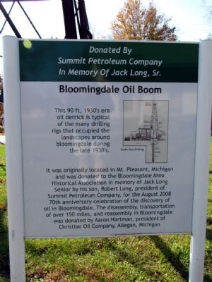
Bloomingdale Oil Boom
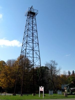
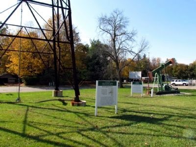
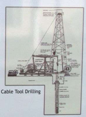
This 90 ft, 1930's era oil derrick is typical of the many drilling rigs that occupied the landscapes around bloomingdale during the late 1930's.
It was originally located in Mt. Pleasant, Michigan and was donated to the Bloomingdale Area Historical Association in memory of Jack Long Senior by his son, Robert Long, president of Summit Petroleum Company, for the August 2008 70th anniversary celebration of the discovery of oil in Bloomingdale. The disassembly, transportation of over 150 miles, and reassembly in Bloomingdale was donated by Aaron Hartman, president of Christian Oil Company, Allegan, Michigan.
Donated by Summit Petroleum Company in memory of Jack Long, Sr.
(Side Two)
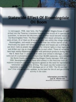
Statewide Effect of Bloomingdale Oil Boom
In mid-August, 1938, near here, the Fisher-McCall Wiggins Estate #1 well drilled into the Traverse Limestone formation and struck oil in spectacular quantities, to become the discovery well of what would become known as the Bloomingdale Field. The Bloomingdale field would ultimately see 437 wells drilled, 45 of them on 80 acres of town lots within the village limits of Bloomingdale, and would produce more than ten million barrels of oil. Practically any space not taken up by people and houses saw a drilling rig put down roots as people signed leases for mineral rights in their back yard and drillers put rigs as close as possible to each other. Three oil refineries here kept nearby Kalamazoo supplied with petroleum products during World War II. More than 11 percent of all wells ever drilled in Michigan, 5,400 wells out of a cumulative total of more than 50,000 statewide, were drilled in Van Buren County and neighboring Allegan County between 1930 and 1939. Development was so rapid and ruthless in this field that both oil explorer/producers and state regulators agreed on the need for legislation to rationalize and regularize drilling. The result was the fundamental legislation enacted in 1939 (Michigan Act 61 of 1939, "The Oil and Gas Law") that still serves, with updates, as the basis for the oil and gas drilling activity in the state.
Information provided by Jack R. Westbrook, retired editor of the Michigan Oil and Gas News
Topics. This historical marker is listed in these topic lists: Industry & Commerce • Settlements & Settlers. A significant historical year for this entry is 2008.
Location. 42° 22.991′ N, 85° 57.494′ W. Marker is in Bloomingdale, Michigan, in Van Buren County. Marker can be reached from the intersection of W. Kalamazoo Street and Oak Street, on the right when traveling west. Marker is located in
Augustus Haven Park near the Bloomingdale Depot Museum. Touch for map. Marker is in this post office area: Bloomingdale MI 49026, United States of America. Touch for directions.
Other nearby markers. At least 8 other markers are within 12 miles of this marker, measured as the crow flies. Bloomingdale Oil Boom (a few steps from this marker); Kalamazoo and South Haven Railroad / Bloomingdale Depot (within shouting distance of this marker); Bloomingdale Veterans Memorial (within shouting distance of this marker); Grand Army of the Republic (approx. 9.1 miles away); The Second Street Bridge (approx. 11.4 miles away); Episcopal Church of Good Shepherd (approx. 11.4 miles away); Welcome to Allegan (approx. 11.4 miles away); James E. Mahan Park (approx. 11.4 miles away). Touch for a list and map of all markers in Bloomingdale.
Credits. This page was last revised on June 16, 2016. It was originally submitted on November 3, 2013, by Duane Hall of Abilene, Texas. This page has been viewed 537 times since then and 28 times this year. Photos: 1, 2, 3, 4, 5. submitted on November 3, 2013, by Duane Hall of Abilene, Texas.
