San Luis Obispo in San Luis Obispo County, California — The American West (Pacific Coastal)
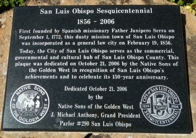
San Luis Obispo Sesquicentennial
1856 – 2006
Today, the City of San Luis Obispo serves as the commercial, governmental and cultural hub of San Luis Obispo County. This plaque was dedicated on October 21, 2006 by the Native Sons of the Golden West in recognition of San Luis Obispo’s achievements and to celebrate its 150-year anniversary.
Dedicated October 21, 2006
by the
Native Sons of the Golden West
J. Michael Anthony, Grand President
Parlor #290 San Luis Obispo
Seal of the Natives Sons of the Golden West (right) and the City of San Luis Obispo (left).
Erected 2006 by Native Sons of the Golden West.
Topics and series. This historical marker is listed in this topic list: Settlements & Settlers. In addition, it is included in the Native Sons/Daughters of the Golden West series list. A significant historical month for this entry is February 1910.
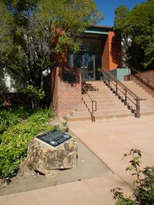
Location. 35° 16.954′ N, 120° 39.755′ W. Marker is in San Luis Obispo, California, in San Luis Obispo County. Marker can be reached from the intersection of Palm Street and Osos Street, on the left when traveling east. Touch for map. Marker is at or near this postal address: 990 Palm Street, San Luis Obispo CA 93401, United States of America. Touch for directions.
Other nearby markers. At least 8 other markers are within walking distance of this marker. General John C. Fremont (about 300 feet away, measured in a direct line); Site of First County Court House (about 300 feet away); J. P. Andrews Building (about 400 feet away); “Love” and “Double Joy” (about 500 feet away); Site of Ah Louis Store (about 600 feet away); Chong's Candy Store (about 700 feet away); Juan Bautista de Anza National Historic Trail (approx. 0.2 miles away); Mission San Luis Obispo de Tolosa (approx. 0.2 miles away). Touch for a list and map of all markers in San Luis Obispo.
Credits. This page was last revised on July 23, 2018. It was originally submitted on November 7, 2013, by Barry Swackhamer of Brentwood, California. This page has been viewed 470 times since then and 21 times this year. Photos: 1, 2. submitted on November 7, 2013, by Barry Swackhamer of Brentwood, California. • Al Wolf was the editor who published this page.

