Darien in McIntosh County, Georgia — The American South (South Atlantic)
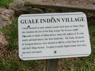
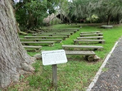
Guale Indian Village
Fort King George Historic Site
Topics. This historical marker is listed in these topic lists: Forts and Castles • Native Americans • Settlements & Settlers. A significant historical year for this entry is 1661.
Location. 31° 21.864′ N, 81° 24.948′ W. Marker is in Darien, Georgia, in McIntosh County. Marker can be reached from the intersection of McIntosh Road and Wayne Street, on the right when traveling north. The marker is located on the grounds of the Fort King George Historical Site. Touch for map. Marker is at or near this postal address: 302 McIntosh Road, Darien GA 31305, United States of America. Touch for directions.
Other nearby markers. At least 8 other markers are within walking distance of this marker. How Steam Engines Worked (here, next to this marker); Lower Bluff Sawmill (here, next to this marker); 200 Years of Sawmilling (a few steps from this marker); Old Fort King George (a few steps from this marker); To The Soldiers Of Fort King George (within shouting distance of this marker); The Savannah Lumber Company (within shouting distance of this marker); Site of Early Spanish Mission (about 500 feet away, measured in a direct line); Birthplace of John McIntosh Kell (approx. 0.6 miles away). Touch for a list and map of all markers in Darien.
Also see . . . Fort King George Historic Site. (Submitted on November 16, 2013.)
Credits. This page was last revised on June 16, 2016. It was originally submitted on November 15, 2013, by Don Morfe of Baltimore, Maryland. This page has been viewed 751 times since then and 77 times this year. Photos: 1, 2. submitted on November 15, 2013, by Don Morfe of Baltimore, Maryland. • Bernard Fisher was the editor who published this page.

